|
 |
|
|
|
 |
|
|
|
|
 |
|
 |
|
|
|
 |
|
 |
|
|
|
|
|
|
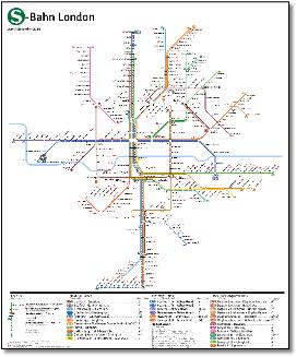
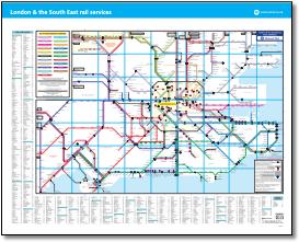
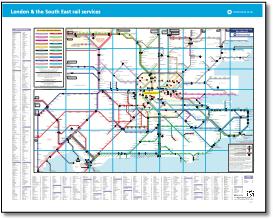
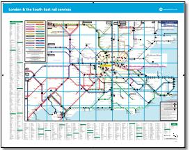
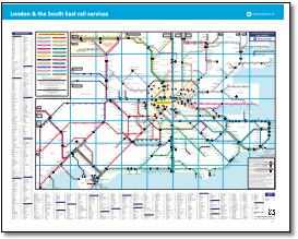
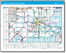
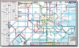
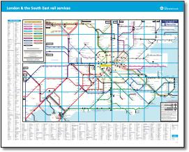
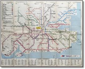
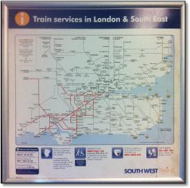
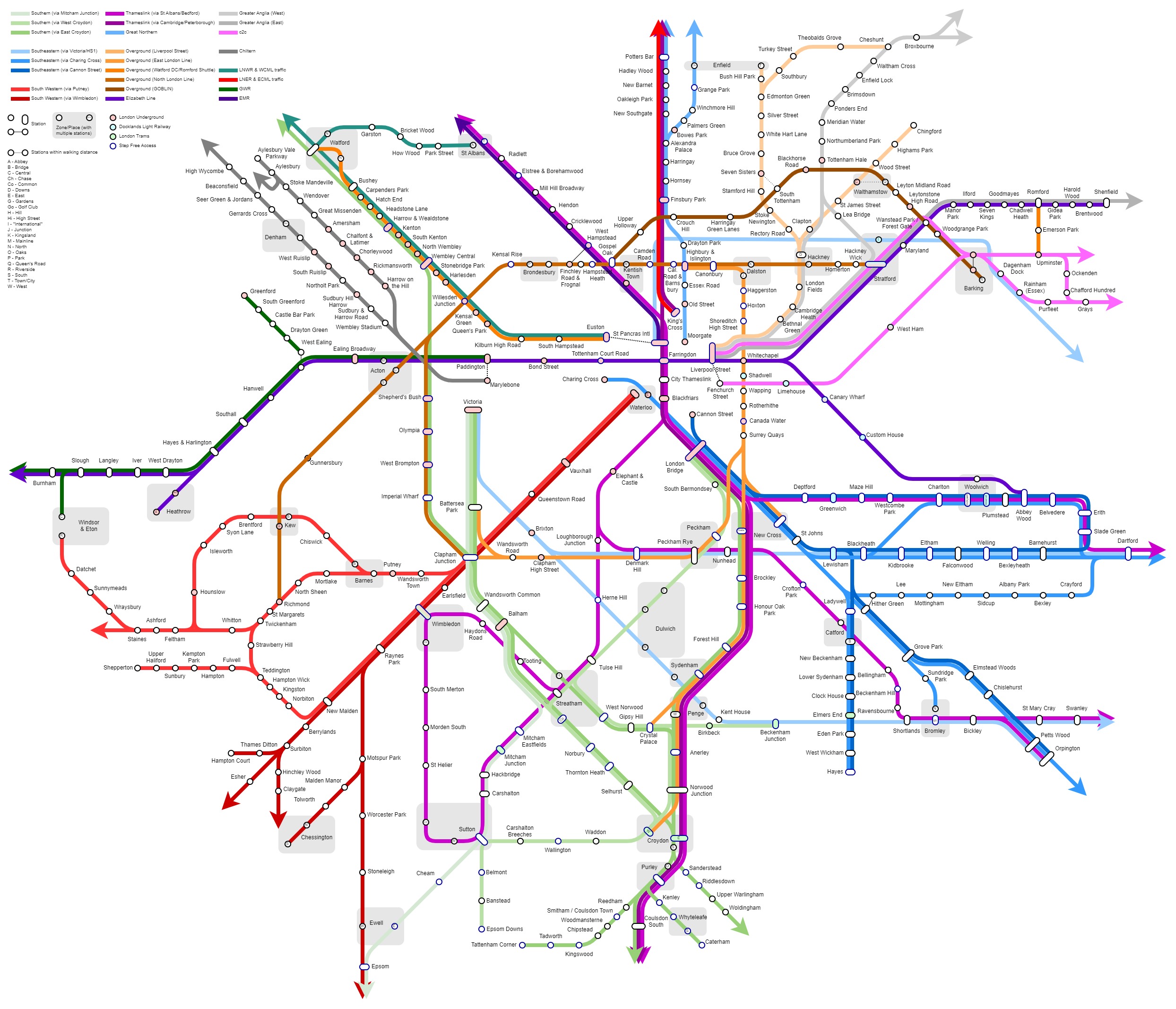
- SWR to Bristol and Weymouth removed, Henley-in-Arden and Wooton Wawen added, Nuneaton-Leamimgton shown as through service, Avanti colour code changed, LNR Bedford shown as through service, TfL Rail becomes Elzabeth line, central section and Heathrow T5 added, Overground added to central section, Norwich and branches to Sherringham, Yarmouth and Lowestoft added, heritage line coding changed, Southern Guildford service removed, GWR to Brighton removed, XC to Guildford removed, Corfe Castle removed, GWR to Axminster added, plus other changes.
|
|
|
|
|
|
 |
|
|
|
|
|
 |
|
|
|
|
|
 |
|
|
|
|
|
 |
|
|
|
 |
|
|
|
|
 |
|
|
|
|
|
|
|
 |
|
|
|
 |
|
|
|
|
|
 |
|
|
|
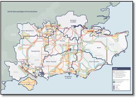
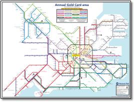
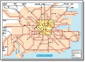
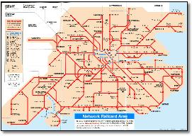
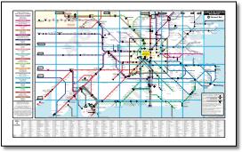
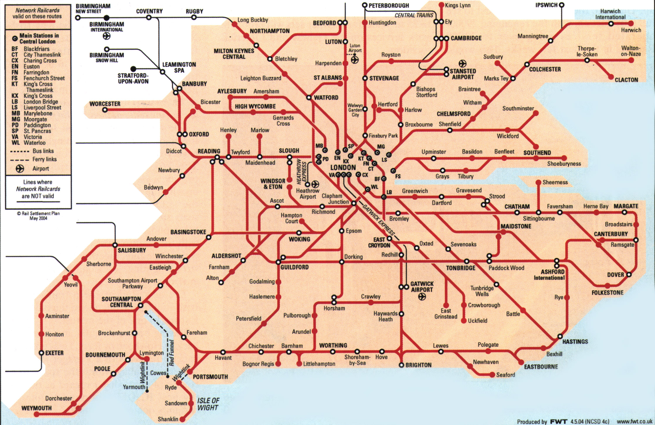
- Now with Network Railcard 'Area of validity' areas added. This extends the map to the East from Yeovil to Exeter, Castle Cary to Taunton, Trowbridge and Swindon to Bristol, Swindon to Gloucester and Charlbury to Great Malvern and additional detail around Birmingham. TOC name updates. Marlow branch shown wrongly at Bourne End.
|
|
|
|
 |
|
|
|
|
|
|
 |
|
|
|
|
 |
|
|
|
|
|
 |
|
|
|
 |
|
|
|
|
|
 |
|
|
|
|
|
 |
|
|
|
|
|
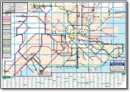
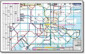
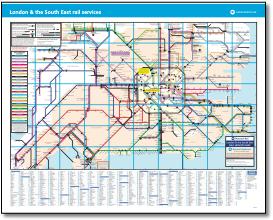
- • Rearrangement of SWR limited service lines around Yeovil
• SWR added from Wareham to Corfe Castle as a limited service
• SouthEastern made limited service Gravesend to Rochester
• Station dots added for Earlswood, Salfords and Horley on Thameslink
• Station dots at Salfords and Earlswood changed to limited service on Southern
• Station dot added at Shoreham by Sea on Thameslink
• Great Northern line between Stevenage and Watton-at-Stone changed to limited service, buses added from Stevenage to Watton-at-Stone and Hertford North
• Chinnor & Princes Risborough Railway added
• Thameslink and Southeastern corrected on North Kent lines to Dartford
• New London Northwestern Railway line from Birmingham New Street towards Walsall
• Limited through service links added at Manningtree and Wickford
• Trowbridge and Melksham added
• Additional lines added at Swindon
|
|
|
|
|
|
 |
|
|
|
|
|
|
|
 |
|
|
|
 |
|
|
|
|
|
 |
|
|
|
|
|
 |
|
|
|
|
|
 |
|
|
|
|
 |
|
|
|
|
|
 |
|
|
|
|
|
 |
|
|
|
 |
|
|
|
|
|
|
 |
|
|
|
|
 |
|
|
|
|
|
 |
|
|
|
 |
 |
|
|
 |
|
|
|
|
 |
|
|
|
|
|
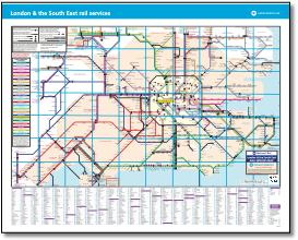
- • Cambridge North added
|
|
|
|
 |
|
|
|
|
 |
|
|
|
|
|
 |
|
|
|
|
|
 |
|
|
|
|
|
 |
|
|
|
|
|
 |
|
|
 |
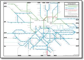
- • Chiltern to Oxford
• EMT & Anglia external route captions added top right
-
|
 |
|
|
|
|
|
|
|
 |
|
|
|
|
 |
|
|
|
|
 |
|
|
|
|
|
 |
|
|
|
|
|
 |
|
|
|
|
|
 |
|
|
|
|
|
|
 |
|
|
|
 |
|
|
 |
|
|
|
|
|
|
 |
|
|
|
|
|
|
|
 |
|
|
|
 |
|
|
|
|
|
|
 |
|
|
|
 |
|
|
|
|
|
 |
|
|
|
|
|
 |
|
|
|
|
 |
|
|
|
|
|
 |
|
|
|
|
|
 |
|
|
|
|
|
 |
|
|
|
|
|
 |
|
|
|
|
|
|
 |
|
|
 |
|
|
|
|
|
 |
|
|
|
|
|
 |
|
|
|
|
|
 |
|
|
|
|
|
 |
|
|
|
|
|
 |
|
|
|
|
 |
|
|
|
|
|
 |
|
|
|
|
|
 |
|
|
|
|
|
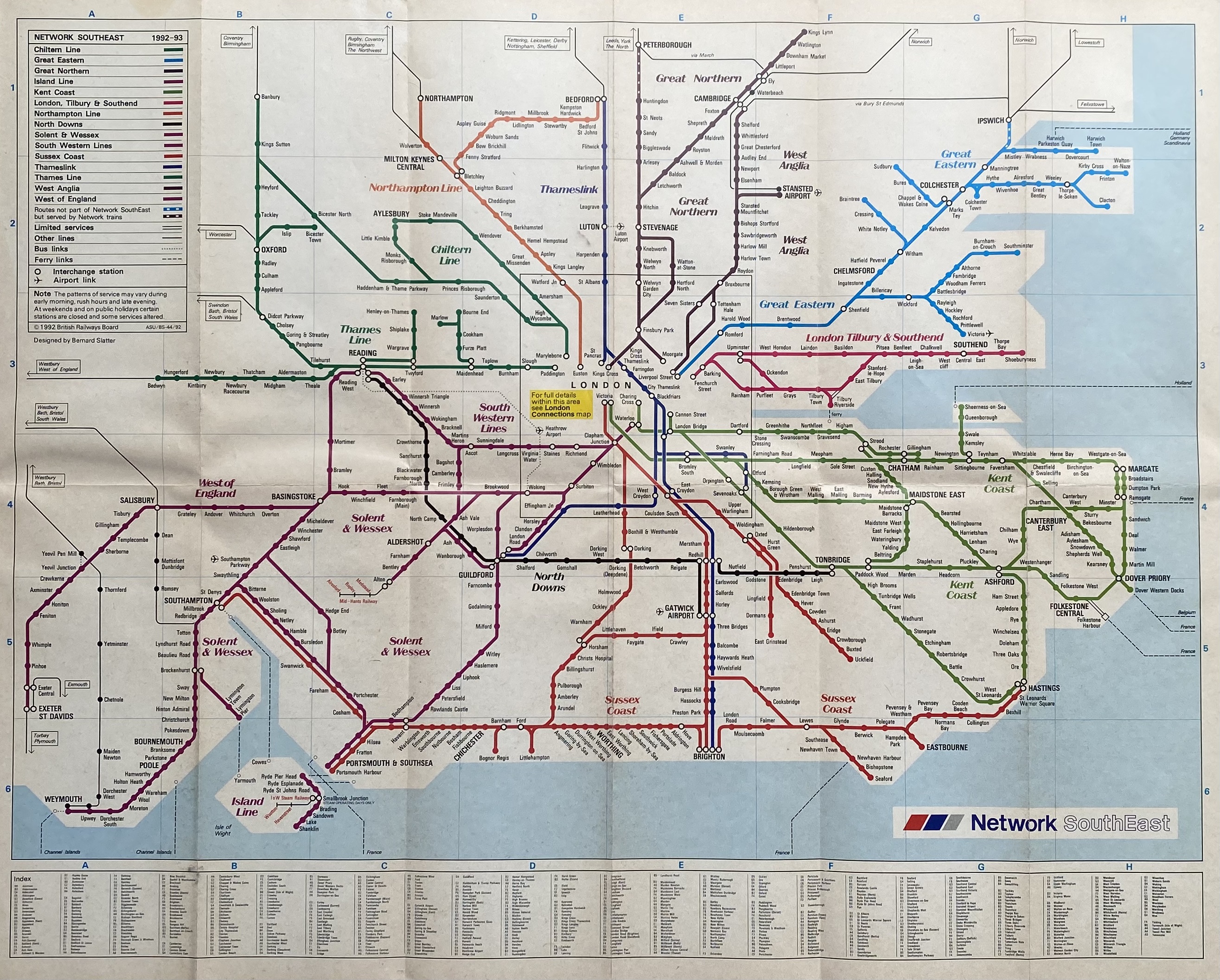
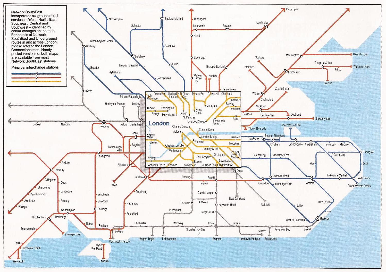
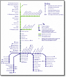
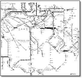
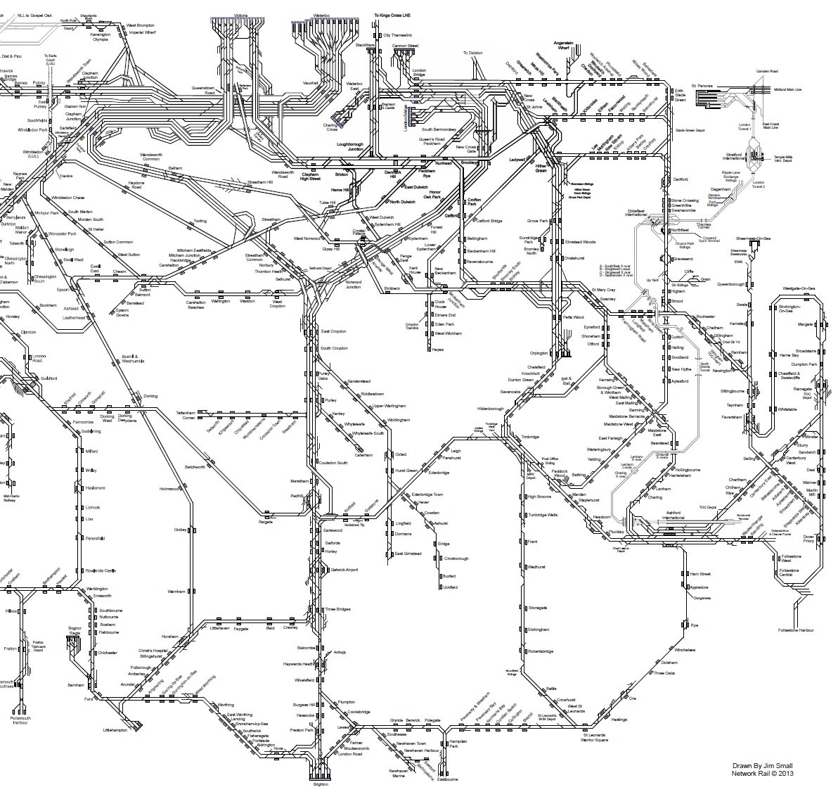
- A tough one to design. But this map has stretch marks - all those west facing lines stretched out while London is over to the right of centre. Perpetuates the awful Romsey loop. I wouldn't have put Exeter in the south-east, but I would have included Felixstowe.
|
|
|
|
|
|
 |
|
|
|
|
|
 |
|
|
|
|
|
|
|
 |
|
|
|
|
|
 |
|
 |
|
|
|
 |
|
|
|
|
|
|
 |
|
|
|
|
|
 |
|
|
|
|
|
 |
|
|
|
|
|
|
|
 |
|
|
|
 |
|
|
|
|
|
 |
|
|
|
|
|
 |
|
|
|
|
|
|
|
 |
|
|
|
|
|
 |
|
|
|
 |
|
|
|
|
|
|
 |
|
|
|
 |
|
|
|
|
|
 |
|
|
|
|
|
|
|
|
|
|
|
|
|
|
|
|
|
|
|
|
|
|
|
|
|
|
|
|
|
|
|
|
|
|
|
|
|
|
|
|
|
|
|
|


.jpg)
1.jpg)