 |
||||||||||||||||
|
|||||
|
|
||||
|
 |
|
|||
|
|||||
|
|||||
|
|||||
 |
|||||||||||||||||||||||||||||||||||||
 |
|||||||||||||||||||||||||||||||||||||
 |
|||||||||||||||||||||||||||||||||||||
 |
|||||||||||||||||||||||||||||||||||||
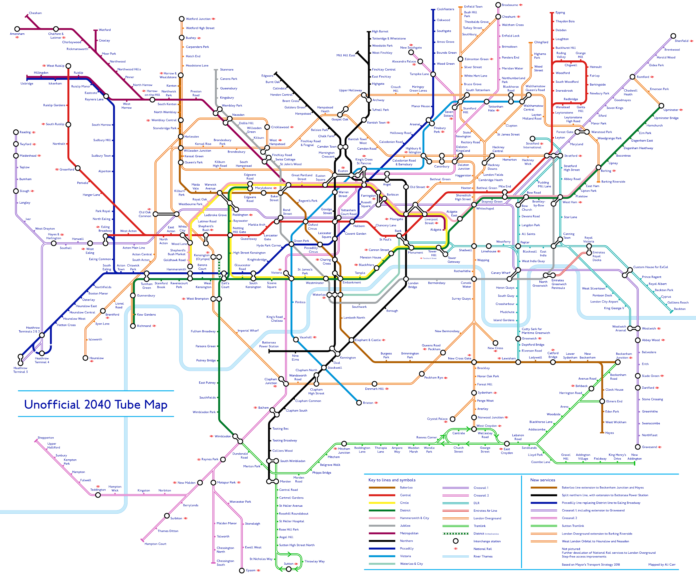
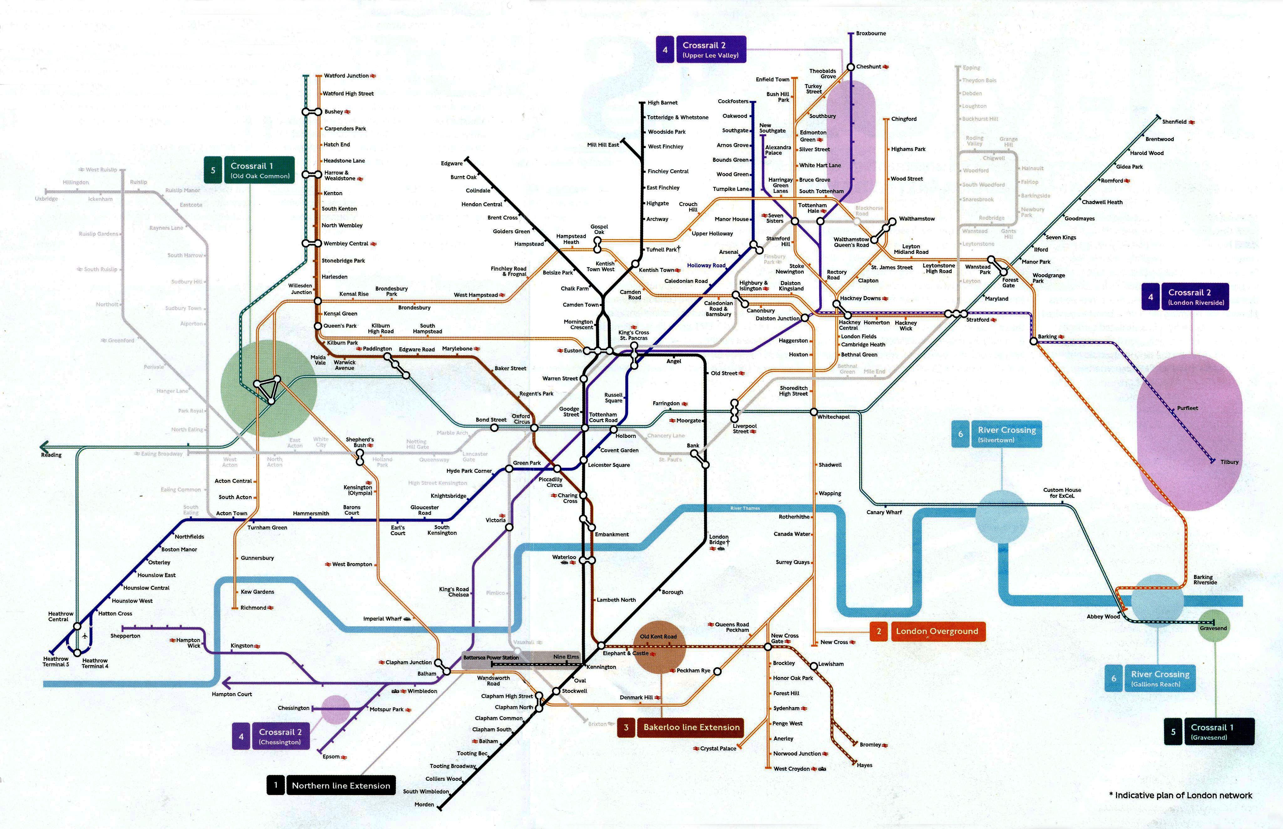
Computer algorithm generated. |
|||||||||||||||||||||||||||||||||||||
TfL Rail extended to Reading. |
|||||||||||||||||||||||||||||||||||||
 |
|||||||||||||||||||||||||||||||||||||
 |
|||||||||||||||||||||||||||||||||||||
 |
|||||||||||||||||||||||||||||||||||||
Now with Crossrail (Elizabeth line). |
|||||||||||||||||||||||||||||||||||||
 |
|||||||||||||||||||||||||||||||||||||
 |
|||||||||||||||||||||||||||||||||||||
 |
|||||||||||||||||||||||||||||||||||||
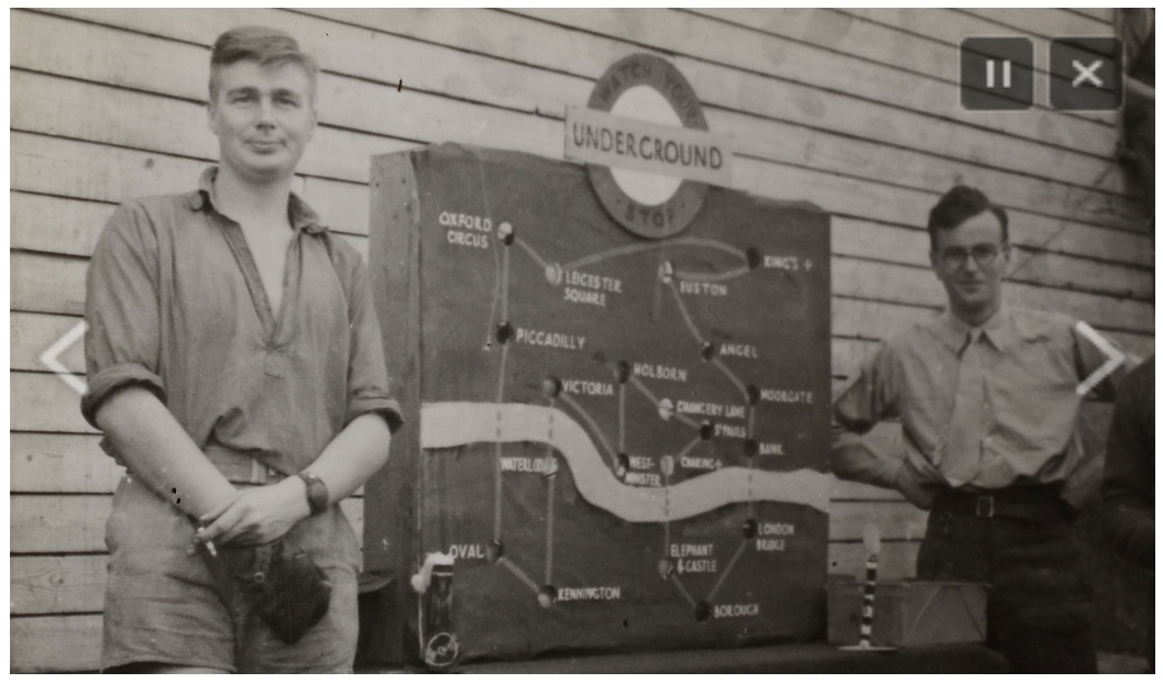
What's going on at Kings Cross? The file is ridiculously large. |
|||||||||||||||||||||||||||||||||||||
 |
|||||||||||||||||||||||||||||||||||||
 |
|||||||||||||||||||||||||||||||||||||
 |
|||||||||||||||||||||||||||||||||||||
 |
|||||||||||||||||||||||||||||||||||||
 |
|||||||||||||||||||||||||||||||||||||
 |
|||||||||||||||||||||||||||||||||||||
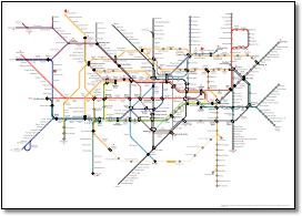
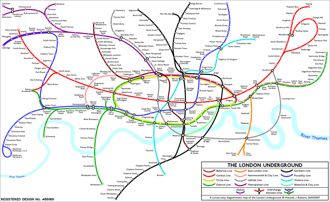
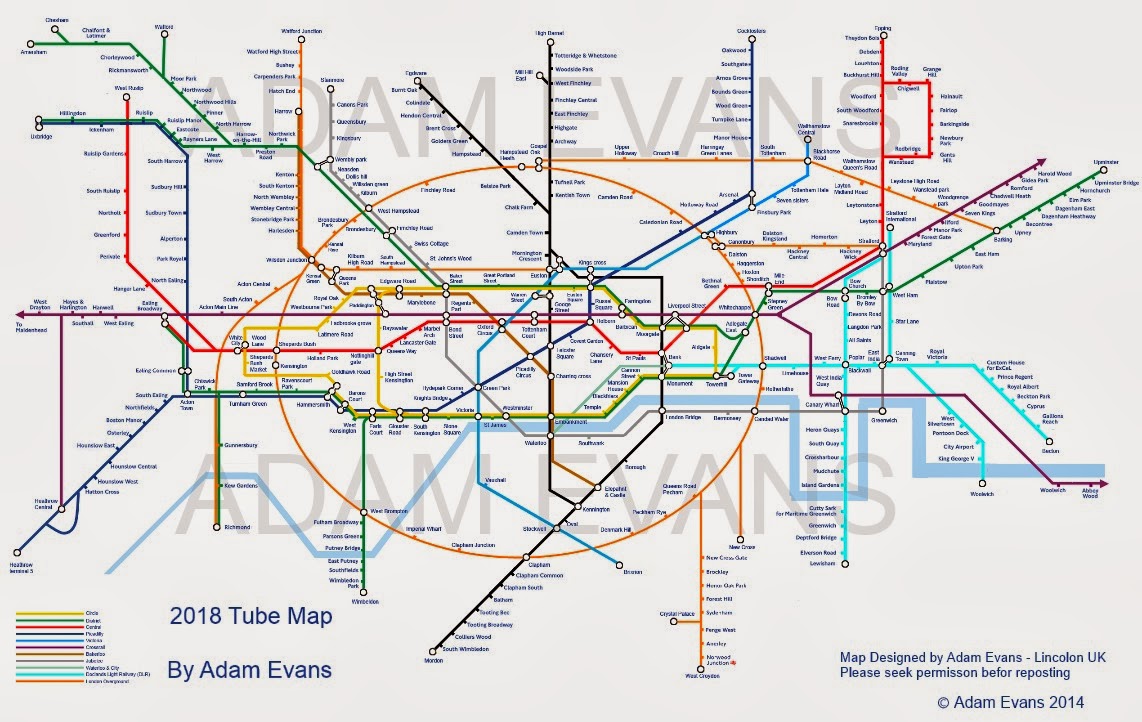
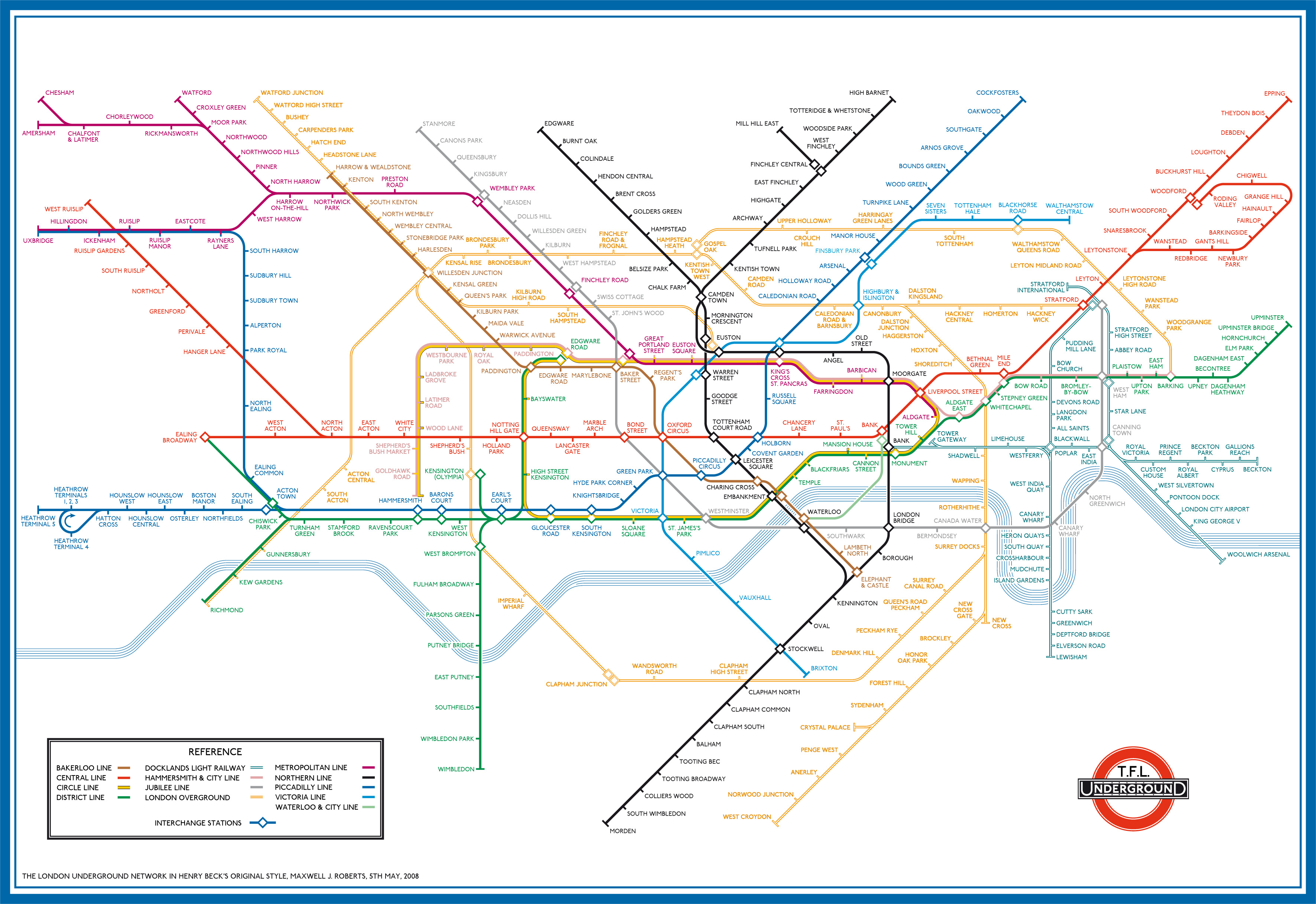
Uses 3-letter station codes instead of full names to demonstrate how much easier it is to design a map without long names. Enables such beauties as Stratford. |
|||||||||||||||||||||||||||||||||||||
 |
|||||||||||||||||||||||||||||||||||||
 |
|||||||||||||||||||||||||||||||||||||
 |
|||||||||||||||||||||||||||||||||||||
 |
|||||||||||||||||||||||||||||||||||||
 |
|||||||||||||||||||||||||||||||||||||
 |
|||||||||||||||||||||||||||||||||||||
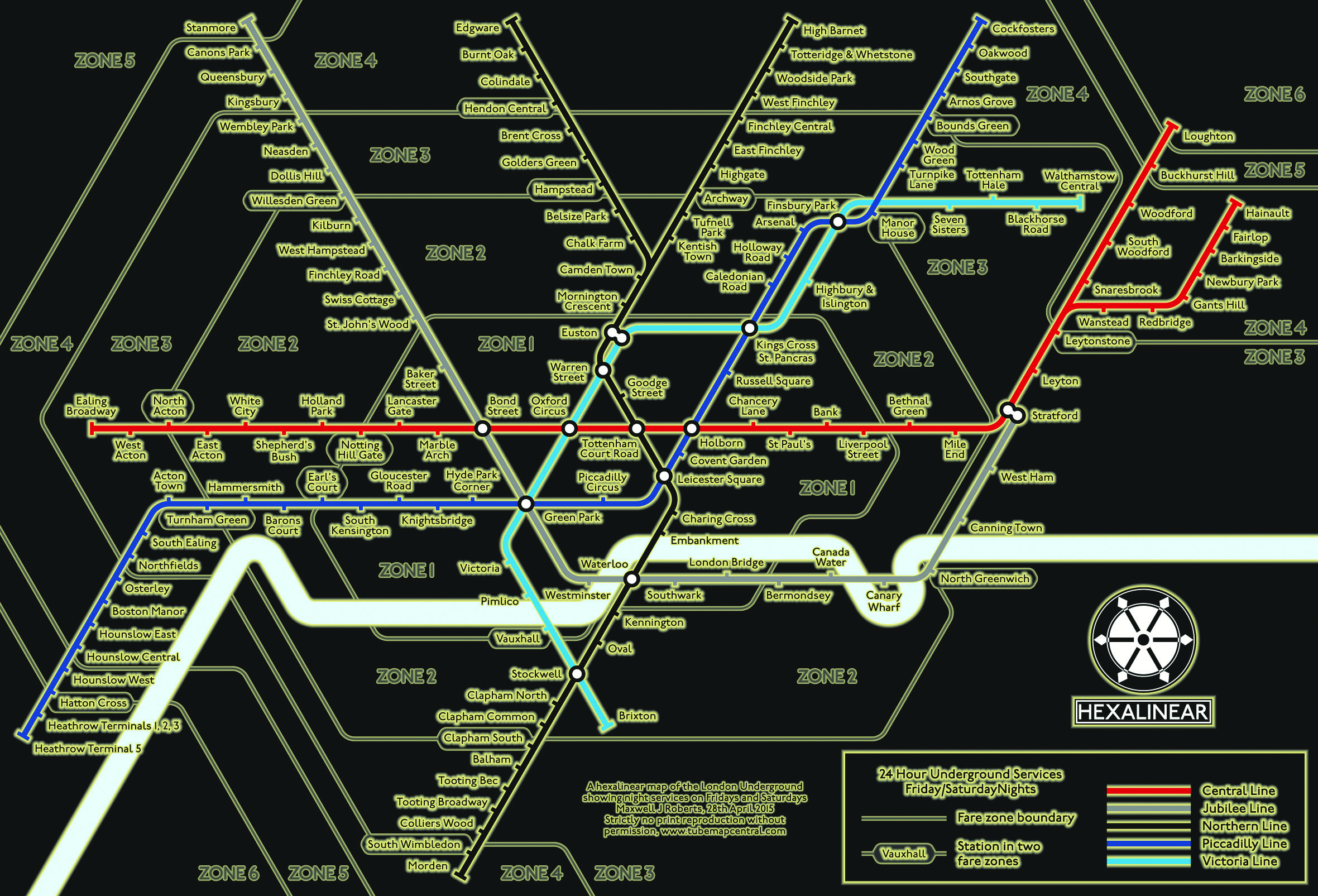
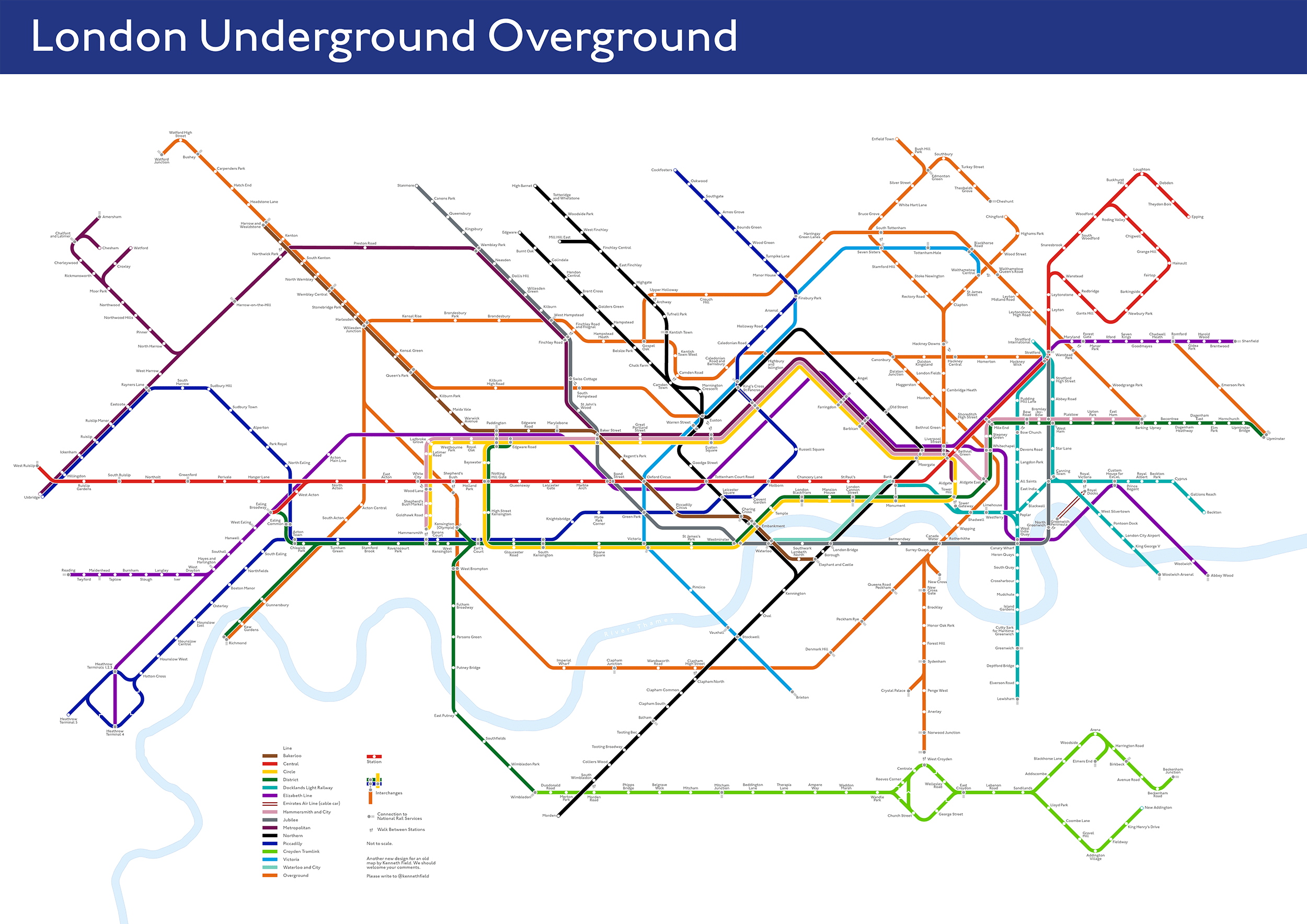
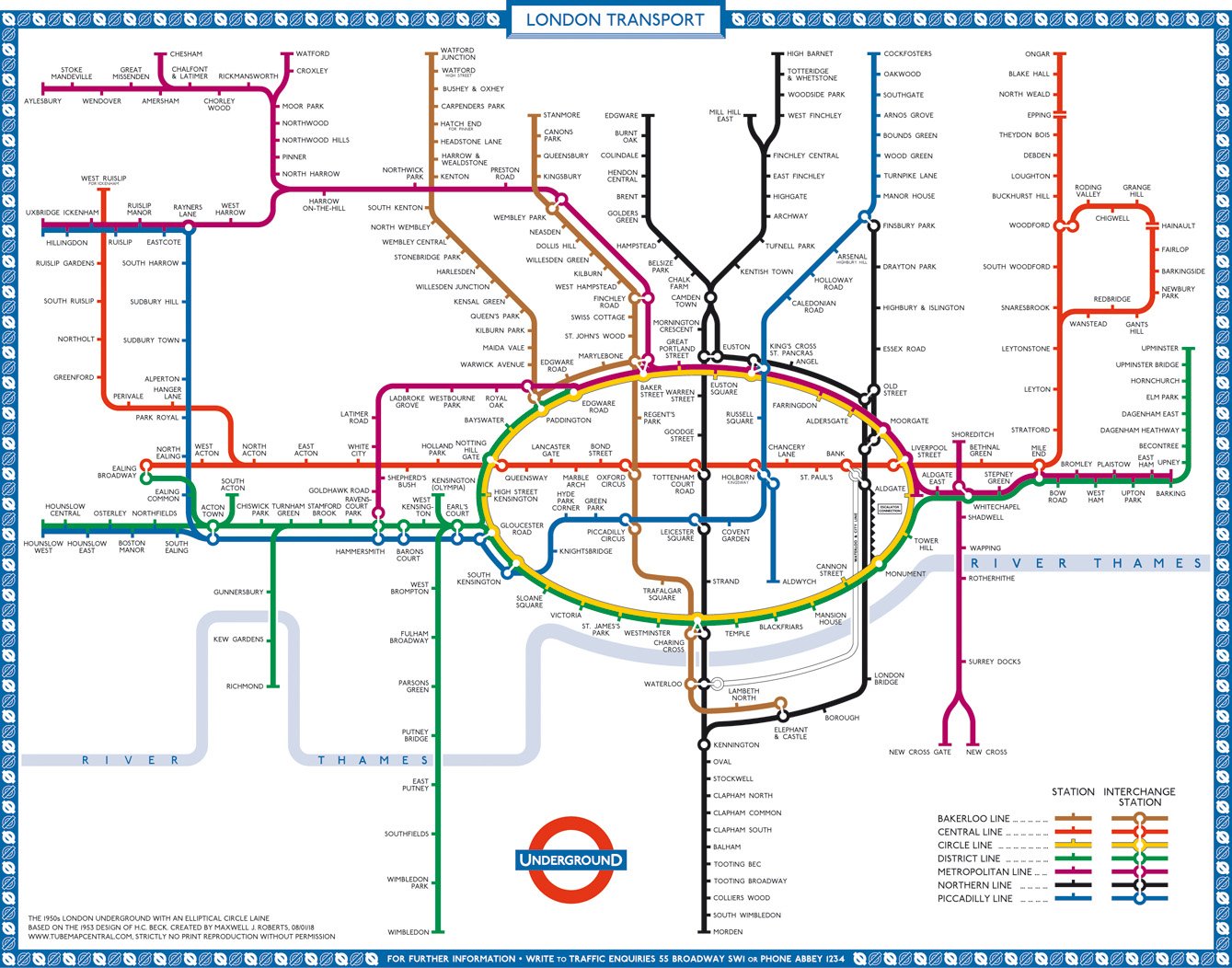
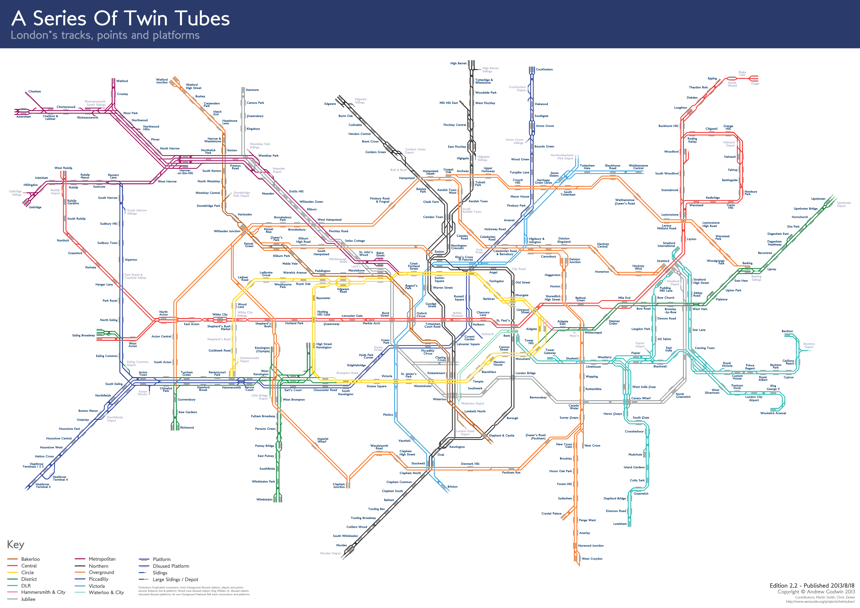
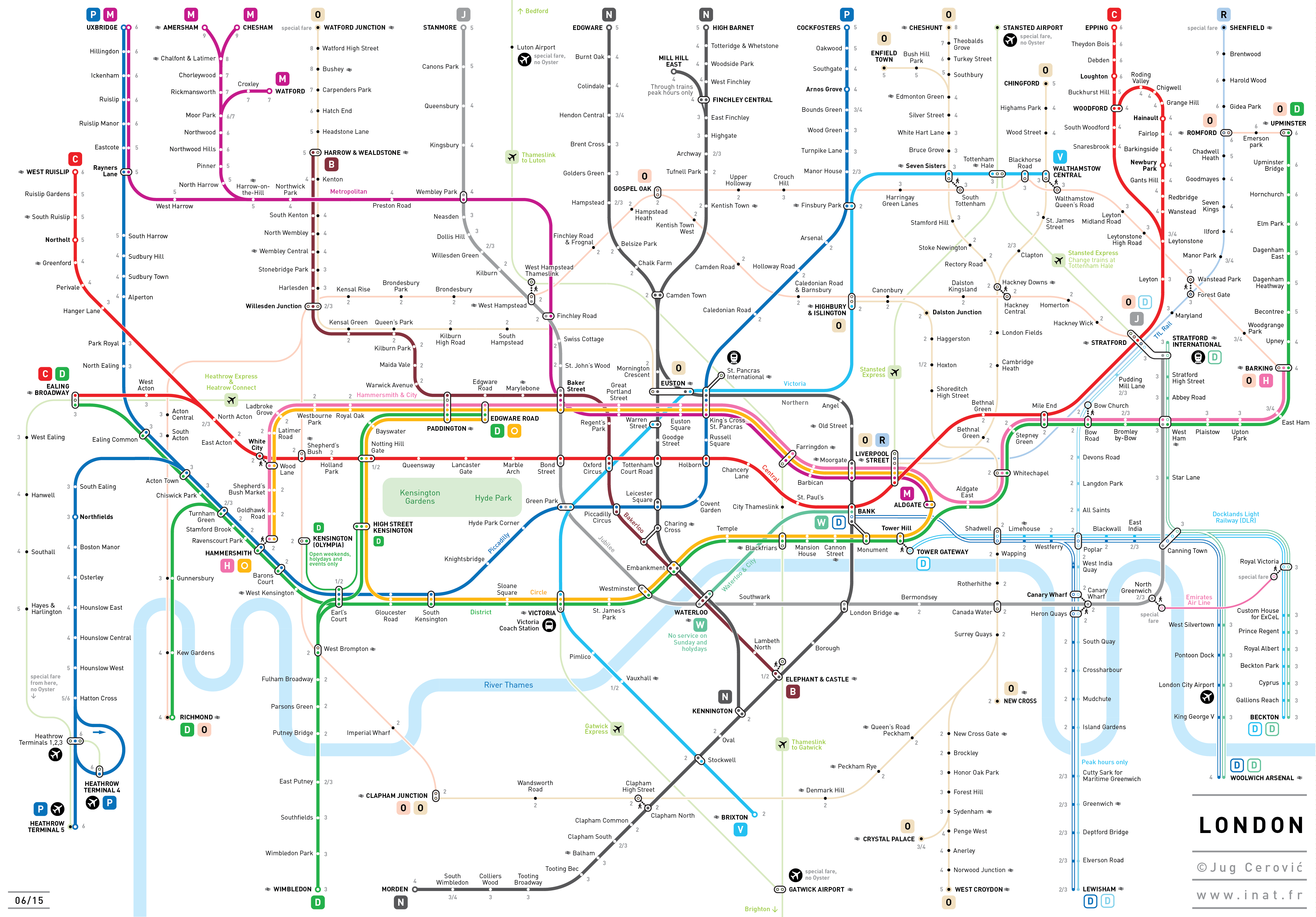
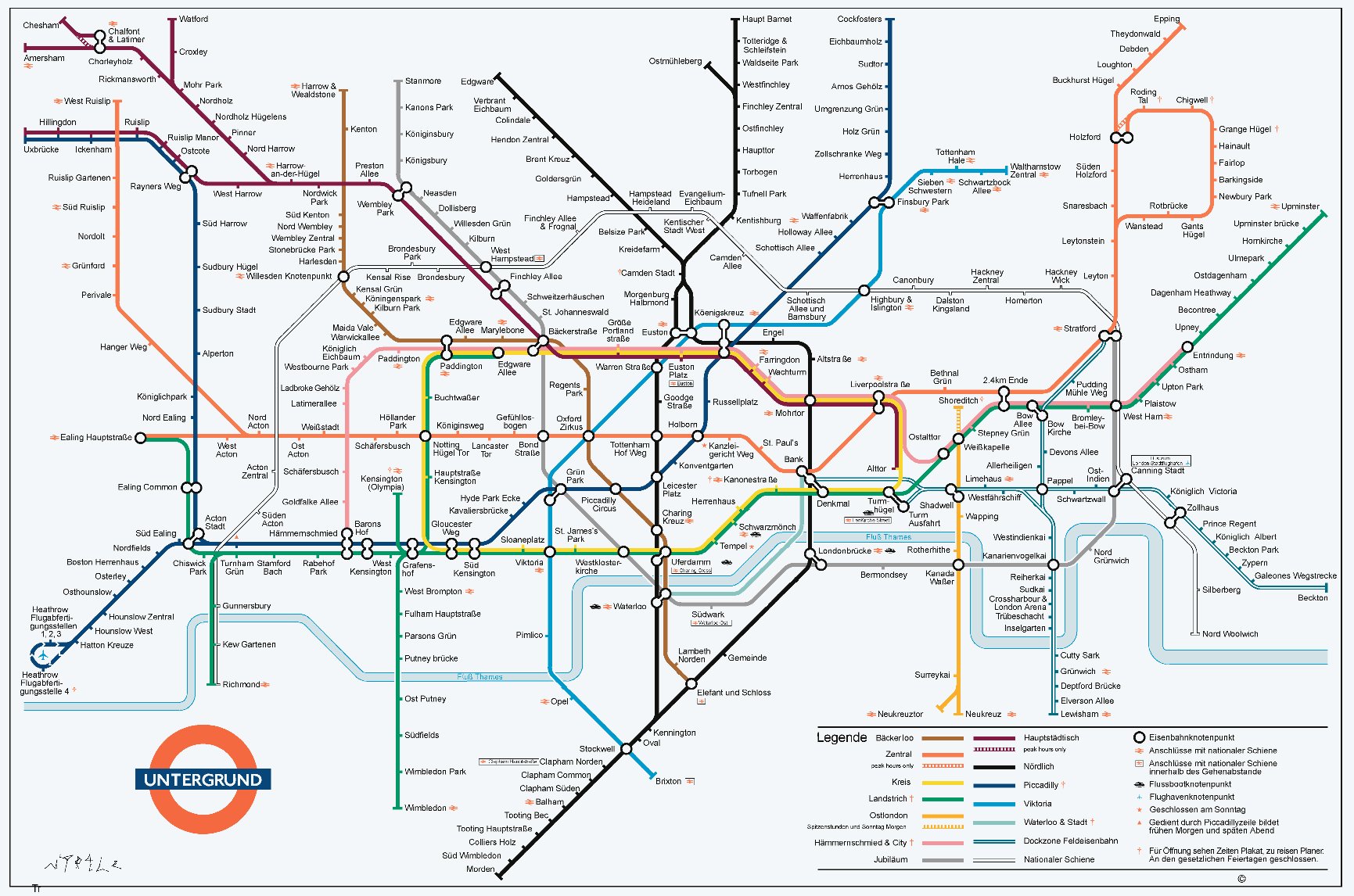
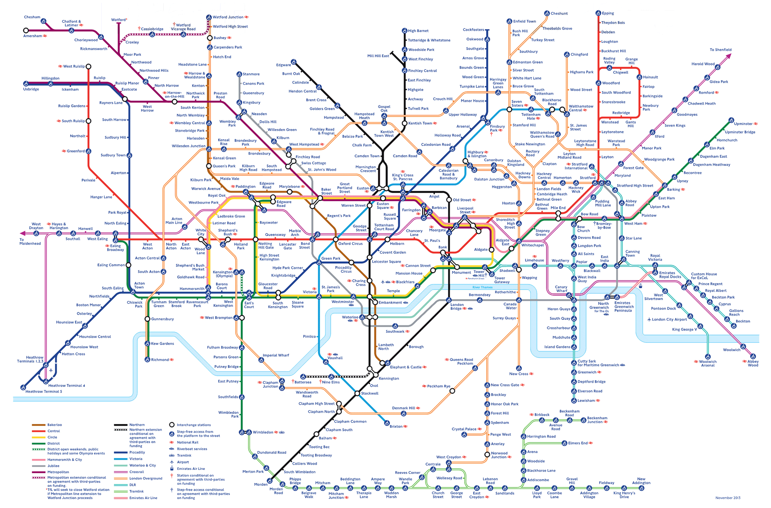
This exercise started because I’ve always been unhappy with the interchange symbol. For example, why should Green Park be one blob but Mile End two, when the first has long walks between distant platforms, the latter has cross-platform interchange. And the interchange symbol is too big for its boots, visually that is, affording too much importance to unimportant locations. |
|||||||||||||||||||||||||||||||||||||
 |
|||||||||||||||||||||||||||||||||||||
 |
|||||||||||||||||||||||||||||||||||||
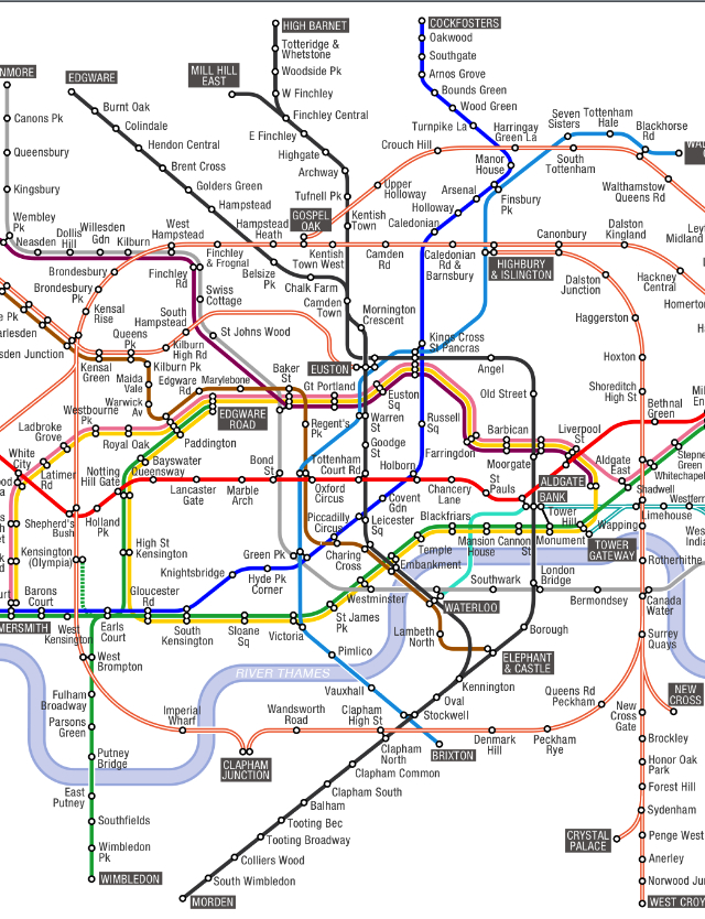
Brilliant background network with the Central and Northern lines straight as they should be; and much better NLL and Goblin routes; much better east London line and DLR. |
|||||||||||||||||||||||||||||||||||||
 |
|||||||||||||||||||||||||||||||||||||
 |
|||||||||||||||||||||||||||||||||||||
 |
|||||||||||||||||||||||||||||||||||||
 |
|||||||||||||||||||||||||||||||||||||
 |
|||||||||||||||||||||||||||||||||||||
 |
|||||||||||||||||||||||||||||||||||||
 |
|||||||||||||||||||||||||||||||||||||
 |
|||||||||||||||||||||||||||||||||||||
 |
|||||||||||||||||||||||||||||||||||||
 |
|||||||||||||||||||||||||||||||||||||
 |
|||||||||||||||||||||||||||||||||||||
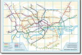
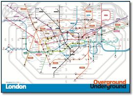
Interesting idea to make London a bit more London-shaped and outer areas more geographic but the adherence to 45º makes it look like its had an electric shock. Also interesting idea to show tunnel portals, a bit like the Crossrail map. |
|||||||||||||||||||||||||||||||||||||
 |
|||||||||||||||||||||||||||||||||||||
 |
|||||||||||||||||||||||||||||||||||||
%20CIL1.jpg) |
|||||||||||||||||||||||||||||||||||||
 |
|||||||||||||||||||||||||||||||||||||
 |
|||||||||||||||||||||||||||||||||||||
 |
|||||||||||||||||||||||||||||||||||||
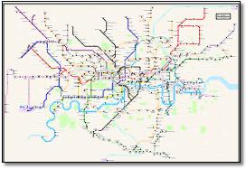
Unsure how Compare Infobase can claim copyright as it is a copy of the TfL version except lines are thinner and non-interchange stations are shown as red blobs - and confusingly on only one route where multiple routes exist, eg Euston Square. Full of mistakes and bad typography, Liverstreet Street, Edgware Road etc etc... |
|||||||||||||||||||||||||||||||||||||
 |
|||||||||||||||||||||||||||||||||||||
1.jpg) |
|||||||||||||||||||||||||||||||||||||
 |
|||||||||||||||||||||||||||||||||||||
 |
|||||||||||||||||||||||||||||||||||||
 |
|||||||||||||||||||||||||||||||||||||
 |
|||||||||||||||||||||||||||||||||||||
%20futureshape1.jpg) |
|||||||||||||||||||||||||||||||||||||
 |
|||||||||||||||||||||||||||||||||||||
 |
|||||||||||||||||||||||||||||||||||||
 |
 |
||||||||||||||||||||||||||||||||||||
 |
|||||||||||||||||||||||||||||||||||||
 |
|||||||||||||||||||||||||||||||||||||
 |
|||||||||||||||||||||||||||||||||||||
 |
|||||||||||||||||||||||||||||||||||||
 |
|||||||||||||||||||||||||||||||||||||
 |
|||||||||||||||||||||||||||||||||||||
 |
|||||||||||||||||||||||||||||||||||||
 |
|||||||||||||||||||||||||||||||||||||
 |
|||||||||||||||||||||||||||||||||||||
 |
|||||||||||||||||||||||||||||||||||||
 |
|||||||||||||||||||||||||||||||||||||
Continued text... This exercise started because I’ve always been unhappy with the interchange symbol. For example, why should Green Park be one blob but Mile End two, when the first has long walks between distant platforms, the latter has cross-platform interchange. And the interchange symbol is too big for its boots, visually that is, affording too much importance to unimportant locations. This is particularly obvious in locations where a double symbol and hatched line connection make that location look so much more important than they are (Finchley Central, Chalfont & Latimer, Woodford, Kennington...) Alex Gollner kindly allowed me to use his file for this exercise and although I’ve tried to leave his map pretty much alone, I have made curves softer, notably at Angel (which has a space penalty but provides a less angular, more relaxed looking map). I’ve also dropped most Network Rail and other connectional symbols for the moment just to be able to concentrate on the task in hand. Also two types of station symbol although I can’t make my mind up, to left to right. I also don’t like the London Overground double orange line which doesn’t work when in parallel to another line (ie Queens Park - Harrow & Wealdstone). I’ve spent far too long on this and now appreciate what a very hard map this is to design, so a lot of respect for everyone that has tried. One thing can be sure, most of the alternatives are better than TfLs! Other changes: East London & docklands closer in, west London stretched out including a wider Earls Court. I thought my solution to King’s Cross was good (subsurface, tube and Thameslink complexes) but no good as there is still an implication that to get from Met to Thameslink you have to go via the tube. Current map is poor as it mixes systems: tube are named lines, Overground four unidentified lines. (Names have been suggested for these including the ‘Brunel’ line for the East London line.) Points: Distortions: Have joined together lines that actually share the same formation, so Bakerloo & Met, District & Piccadilly, but does Canning Town - Stratford? Got the two Watfords closer together; City loop smaller; south side of circle closer to top; Alignment: Watford branch & Pic, Watford DC line & WLL, Central & Circle, Jubilee and District, Bakerloo & Victoria and Piccadilly & Victoria at Green Park, NLL and Thameslink. |
|||||||||||||||||||||||||||||||||||||