 |
||||||||||||||||
|
|||||
|
|
||||
|
 |
|
|||
|
|||||
|
|||||
|
|||||
 |
 |
 |
||||||||||||||||||||||||||||||||||||||||||
 |
||||||||||||||||||||||||||||||||||||||||||||
 |
||||||||||||||||||||||||||||||||||||||||||||
 |
||||||||||||||||||||||||||||||||||||||||||||
 |
||||||||||||||||||||||||||||||||||||||||||||
 |
||||||||||||||||||||||||||||||||||||||||||||
 |
||||||||||||||||||||||||||||||||||||||||||||
 |
||||||||||||||||||||||||||||||||||||||||||||
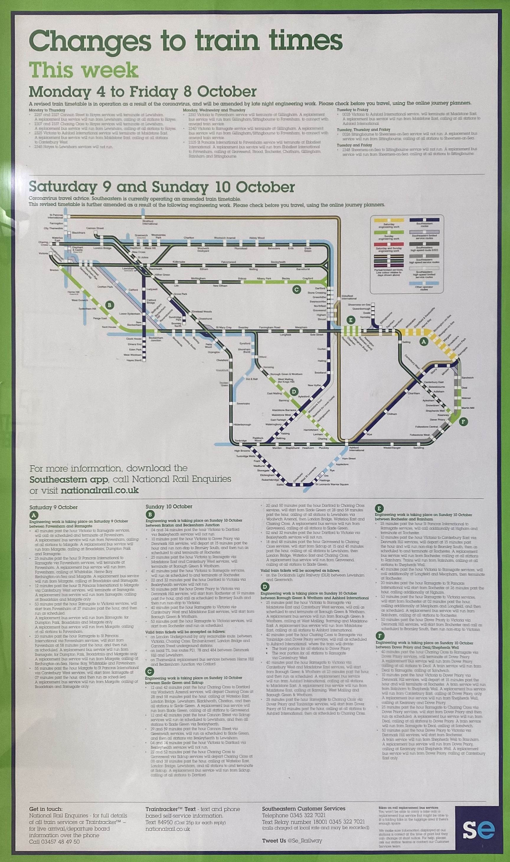
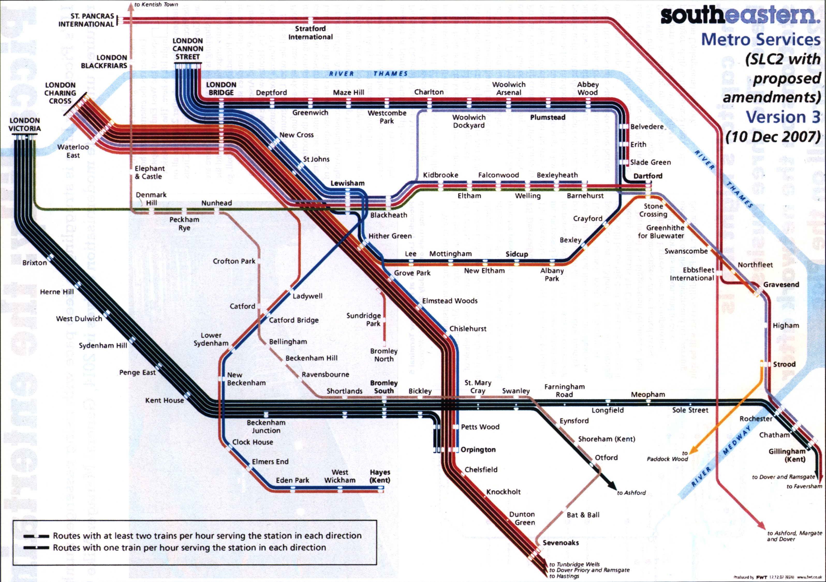
With London Bridge fully open. |
||||||||||||||||||||||||||||||||||||||||||||
 |
||||||||||||||||||||||||||||||||||||||||||||
 |
||||||||||||||||||||||||||||||||||||||||||||
 |
||||||||||||||||||||||||||||||||||||||||||||
With London Bridge reconstruction work. |
||||||||||||||||||||||||||||||||||||||||||||
 |
 |
|||||||||||||||||||||||||||||||||||||||||||
 |
||||||||||||||||||||||||||||||||||||||||||||
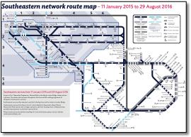
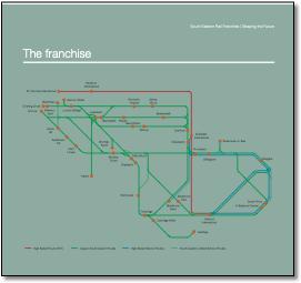
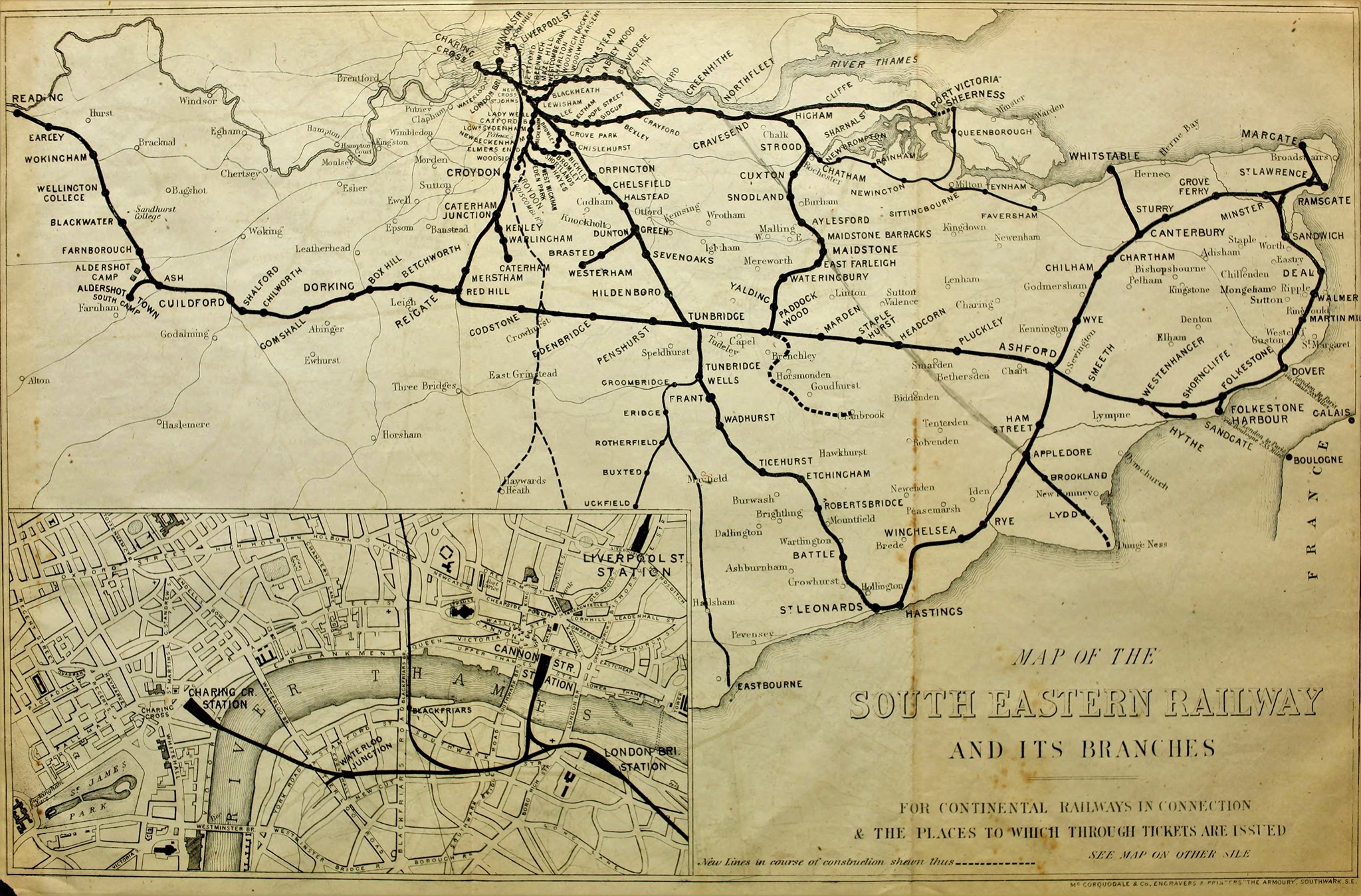
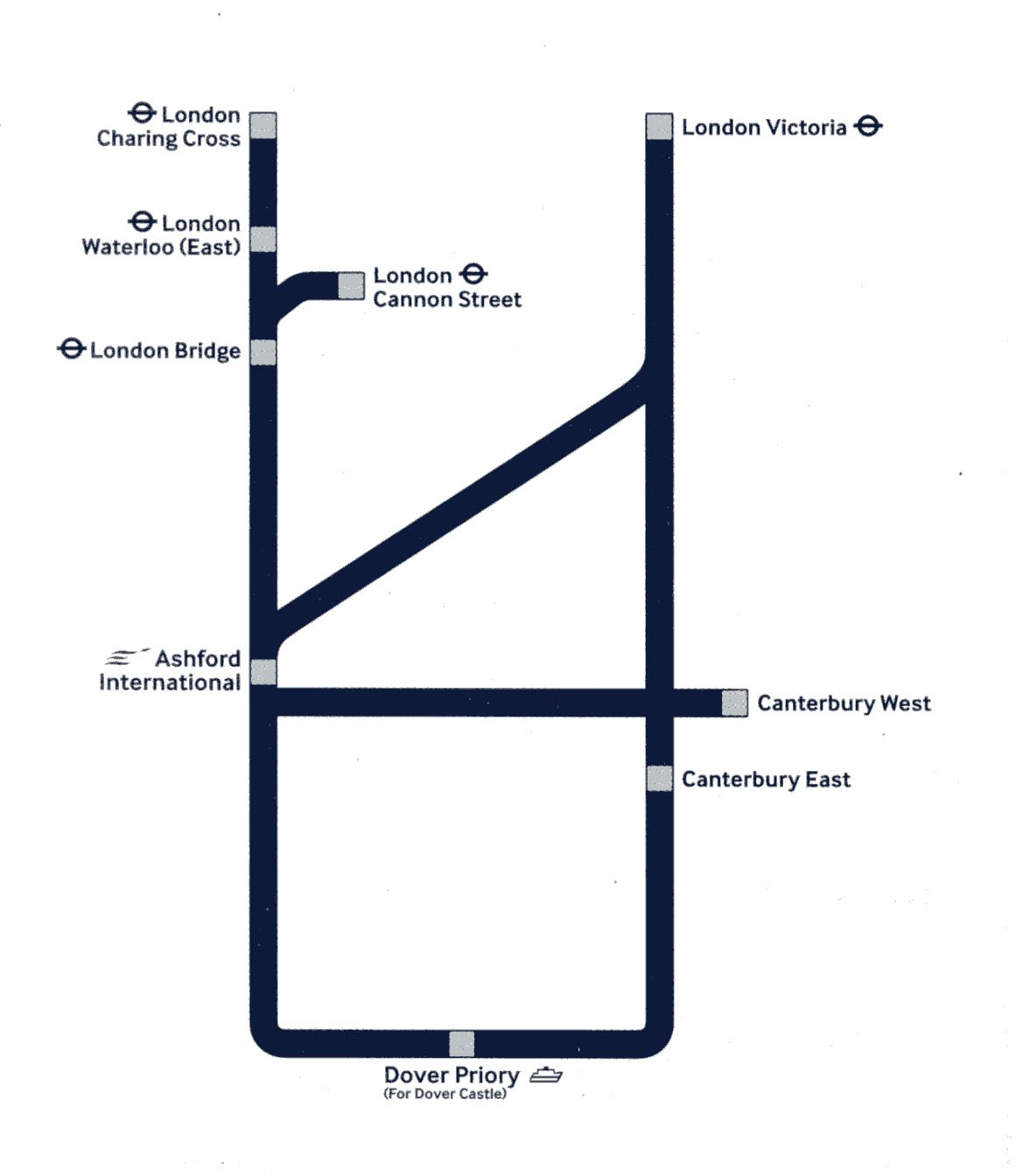
Routes colour-coded to three London terminals. Better impression of multiple routes into London. Suggest the Priory be dropped from Dover as its been a long time since there was a Marine, Harbour or Town station. |
||||||||||||||||||||||||||||||||||||||||||||
 |
||||||||||||||||||||||||||||||||||||||||||||
 |
||||||||||||||||||||||||||||||||||||||||||||
 |
||||||||||||||||||||||||||||||||||||||||||||
 |
||||||||||||||||||||||||||||||||||||||||||||
1.jpg) |
||||||||||||||||||||||||||||||||||||||||||||
 |
||||||||||||||||||||||||||||||||||||||||||||
 |
||||||||||||||||||||||||||||||||||||||||||||
 |
||||||||||||||||||||||||||||||||||||||||||||
 |
||||||||||||||||||||||||||||||||||||||||||||
|
||||||||||||||||||||||||||||||||||||||||||||
|
||||||||||||||||||||||||||||||||||||||||||||
 |
||||||||||||||||||||||||||||||||||||||||||||
 |
||||||||||||||||||||||||||||||||||||||||||||
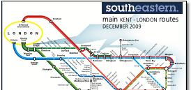
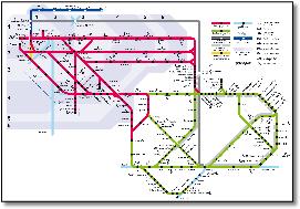
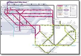
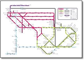
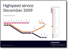
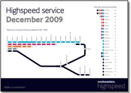
Routes colour-coded. Includes Thameslink to Bedford as joint service. Poor presentation of new fast Javelin services: unclear around Gravesend showing Eurostar running through; North Kent lines stretched too far to right making Javelin/Eurostar very indirect. Map below has been added to without rethink. |
||||||||||||||||||||||||||||||||||||||||||||
 |
||||||||||||||||||||||||||||||||||||||||||||
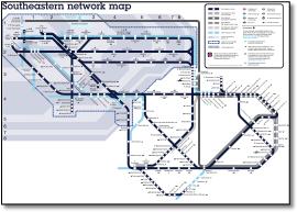
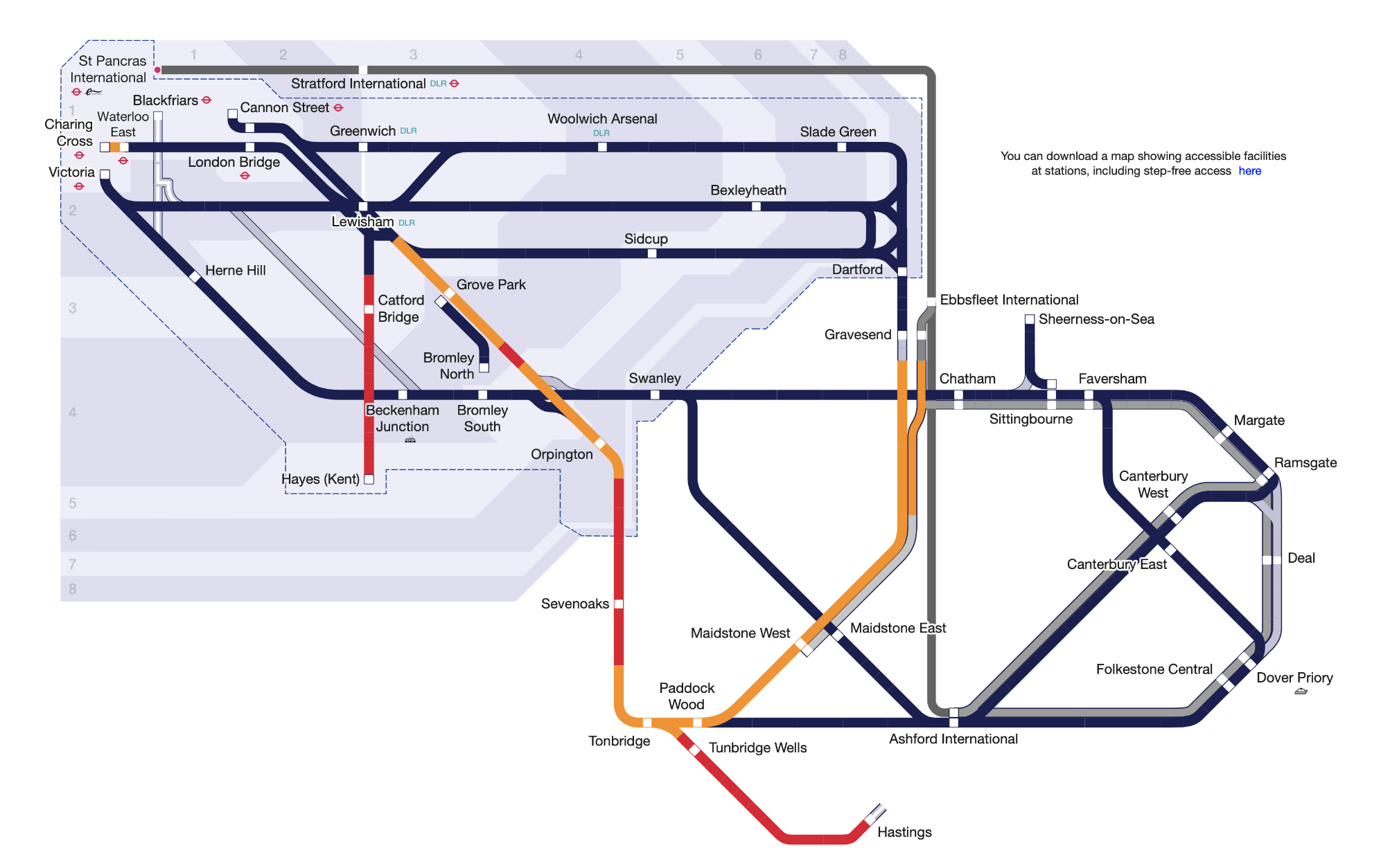
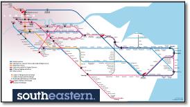
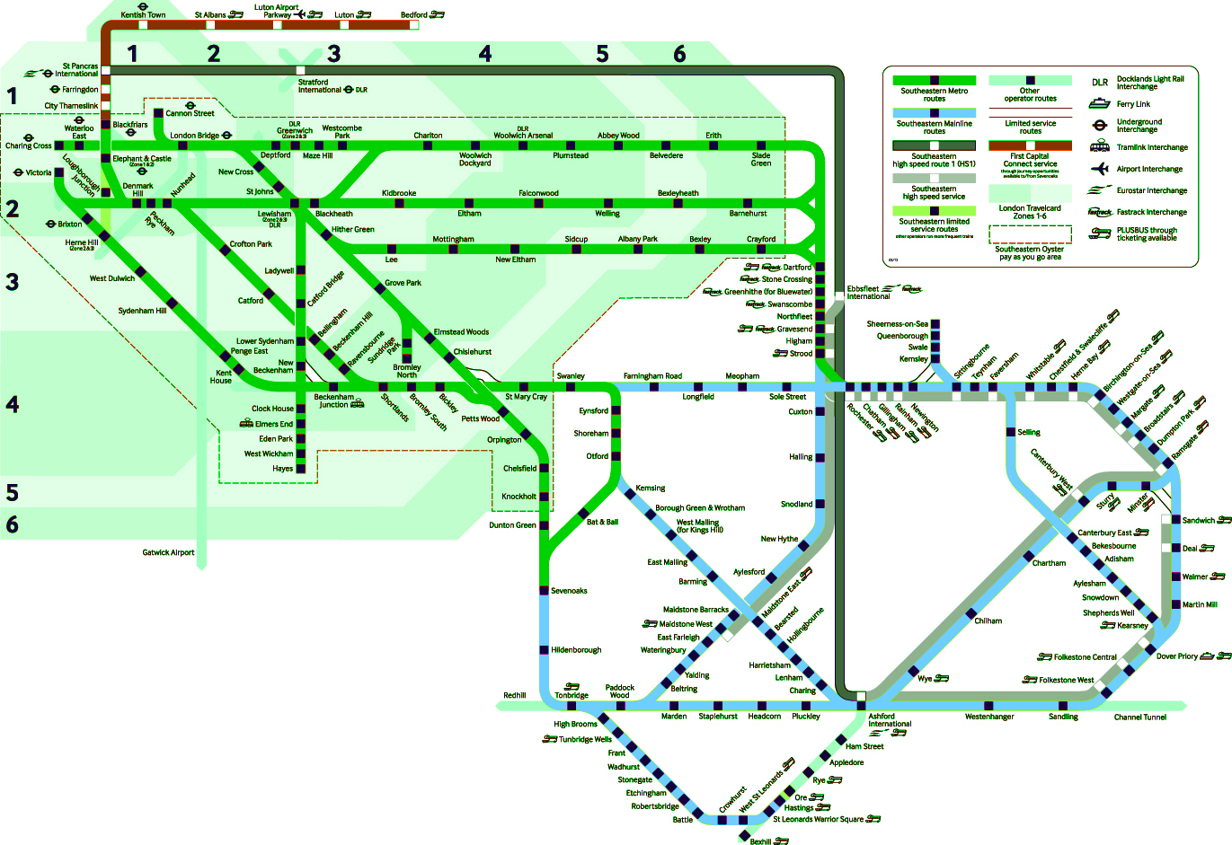
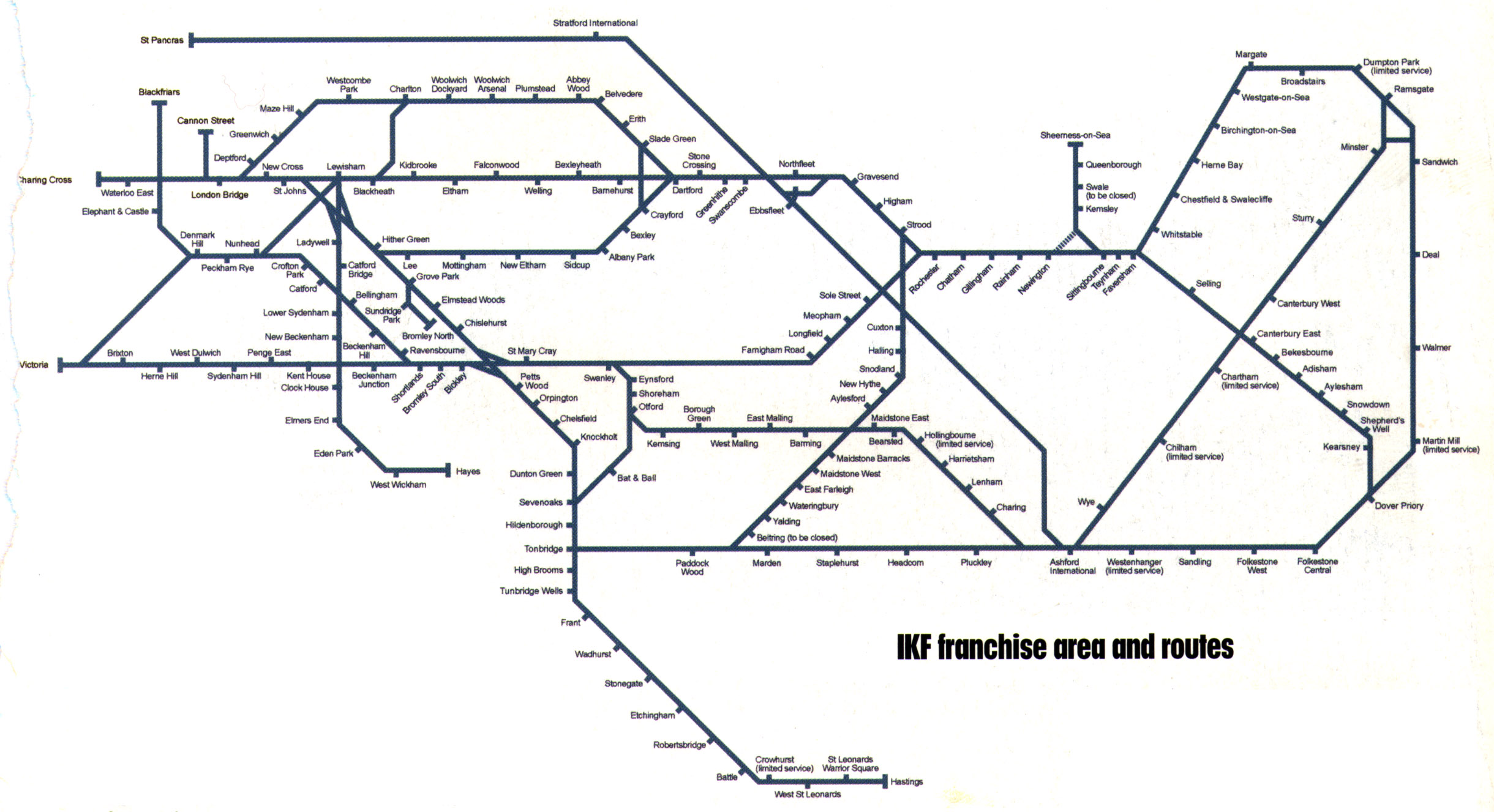
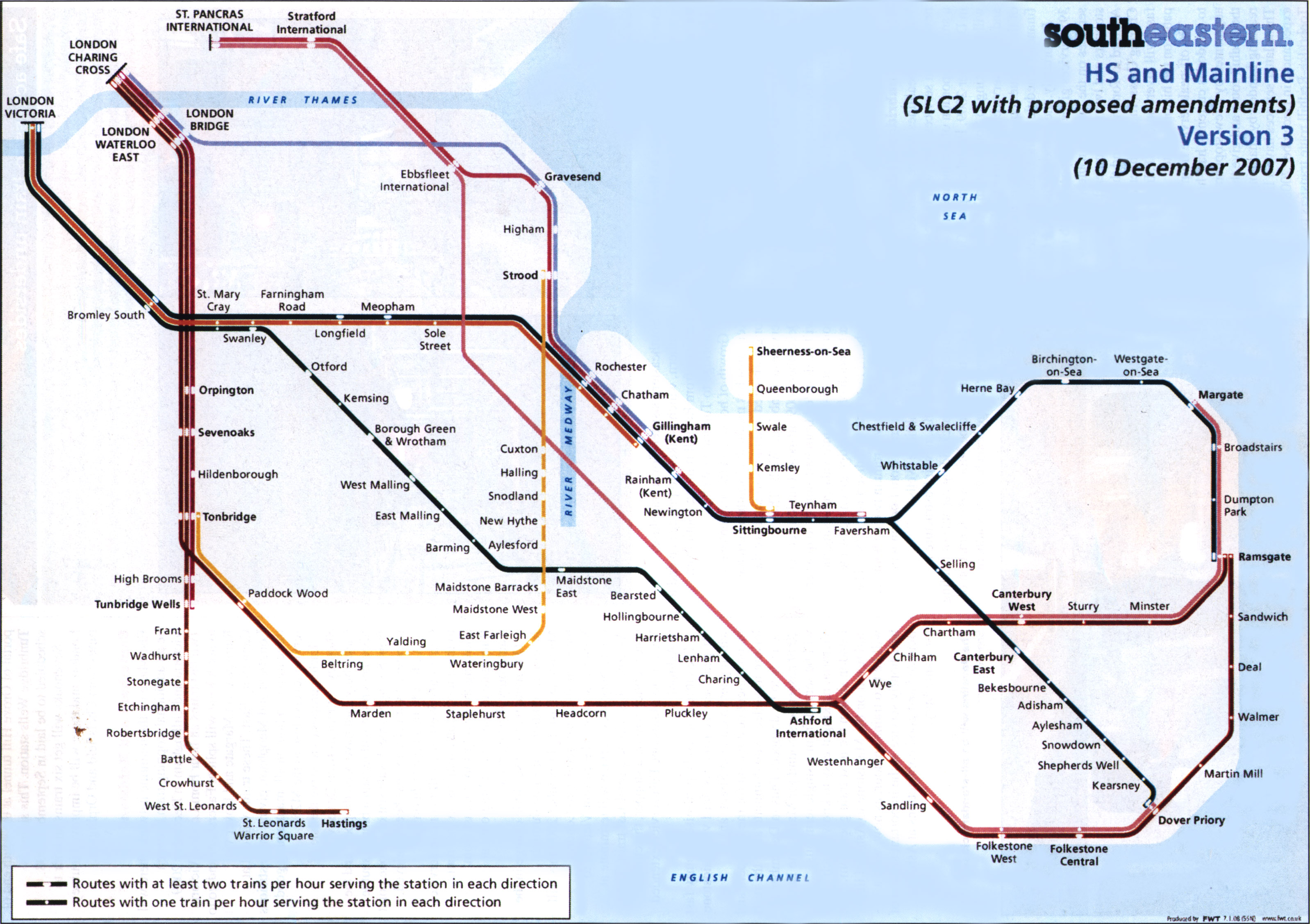
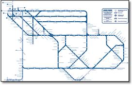
This is a poor map of the type that makes what is simple on the ground unrecognisable. Since when did Kent look that - with a club foot? The map takes the straight and direct SouthEastern main lines (London - Tonbridge - Hastings and Tonbridge - Ashford - Dover) into convoluted multiple angles. The Tonbridge - Dover line is arrow straight (a superb piece of engineering by Cubitt) - why put four bends in it? Not only that but it's so dull you could die of depression just looking at it. Meaningless heading. Buffers at London termini but not elsewhere. Poor geographical relationship between London terminals. Odd and gloomy colour-coding - not distinctive (and two dark browns from Charing Cross). Lines do not cross correctly, eg at Ebbsfleet. No statement as to station selection (stations disappear along North Kent coast). |
||||||||||||||||||||||||||||||||||||||||||||
 |
||||||||||||||||||||||||||||||||||||||||||||
 |
||||||||||||||||||||||||||||||||||||||||||||
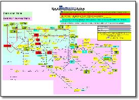
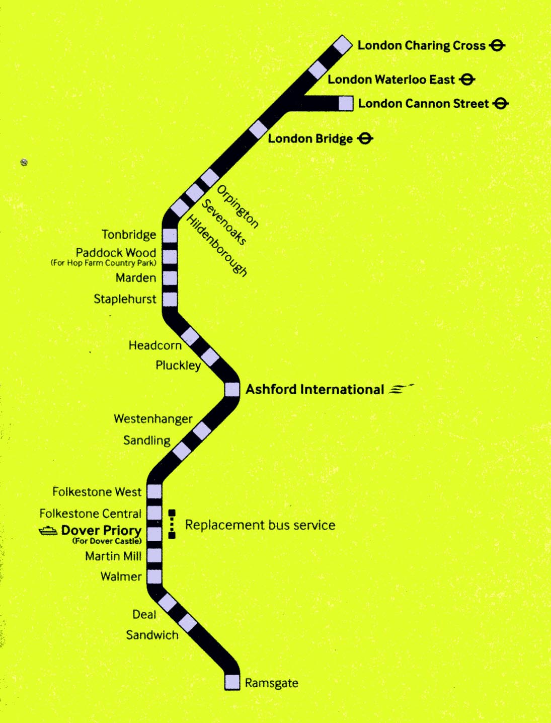
Some extremely small type there. |
||||||||||||||||||||||||||||||||||||||||||||
 |
||||||||||||||||||||||||||||||||||||||||||||
 |
||||||||||||||||||||||||||||||||||||||||||||
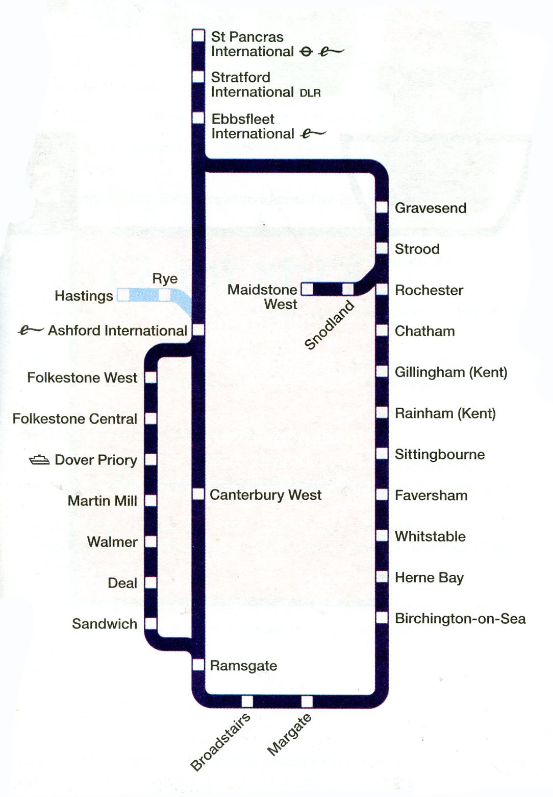
You might not recognise this important route from this map. Ok, it might need spinning through 90º, but why the bends either side of Ashford on what is a straight line? And why the kick at Ramsgate (should be the other way if anything) when not applied to the London termini? Another example of making something simple more complex. |
||||||||||||||||||||||||||||||||||||||||||||
 |
||||||||||||||||||||||||||||||||||||||||||||
 |
||||||||||||||||||||||||||||||||||||||||||||
Victoria east of Charing Cross? |
||||||||||||||||||||||||||||||||||||||||||||
 |
||||||||||||||||||||||||||||||||||||||||||||