 |
||||||||||||||||
|
|||
|
 |
|
|
|
|
||
|
|||
 |
|||||||||||||||||
 |
|||||||||||||||||
 |
|||||||||||||||||
 |
|||||||||||||||||
 |
|||||||||||||||||
 |
|||||||||||||||||
 |
|||||||||||||||||
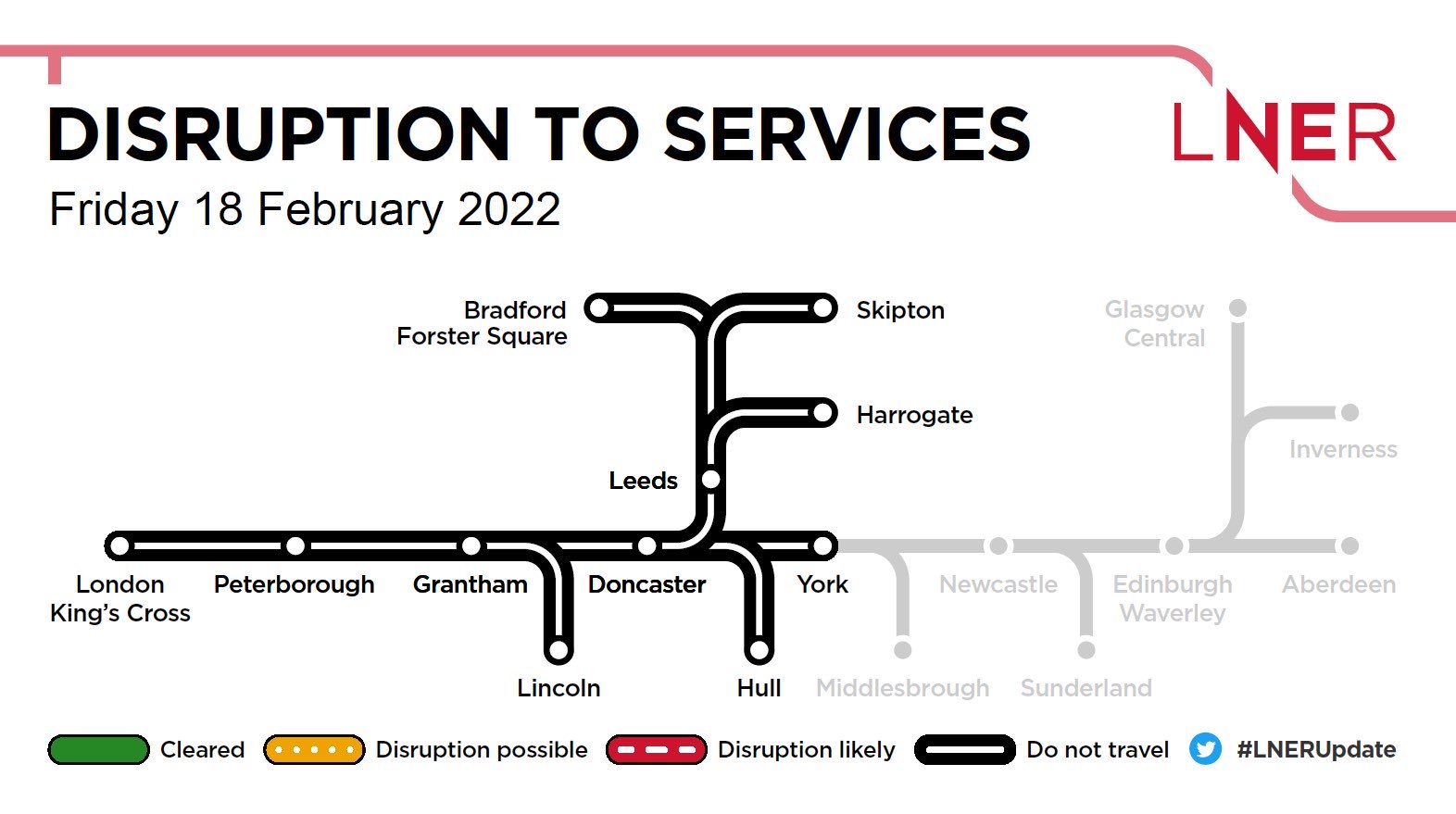
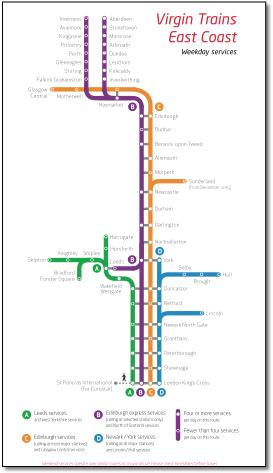
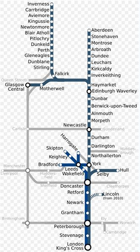
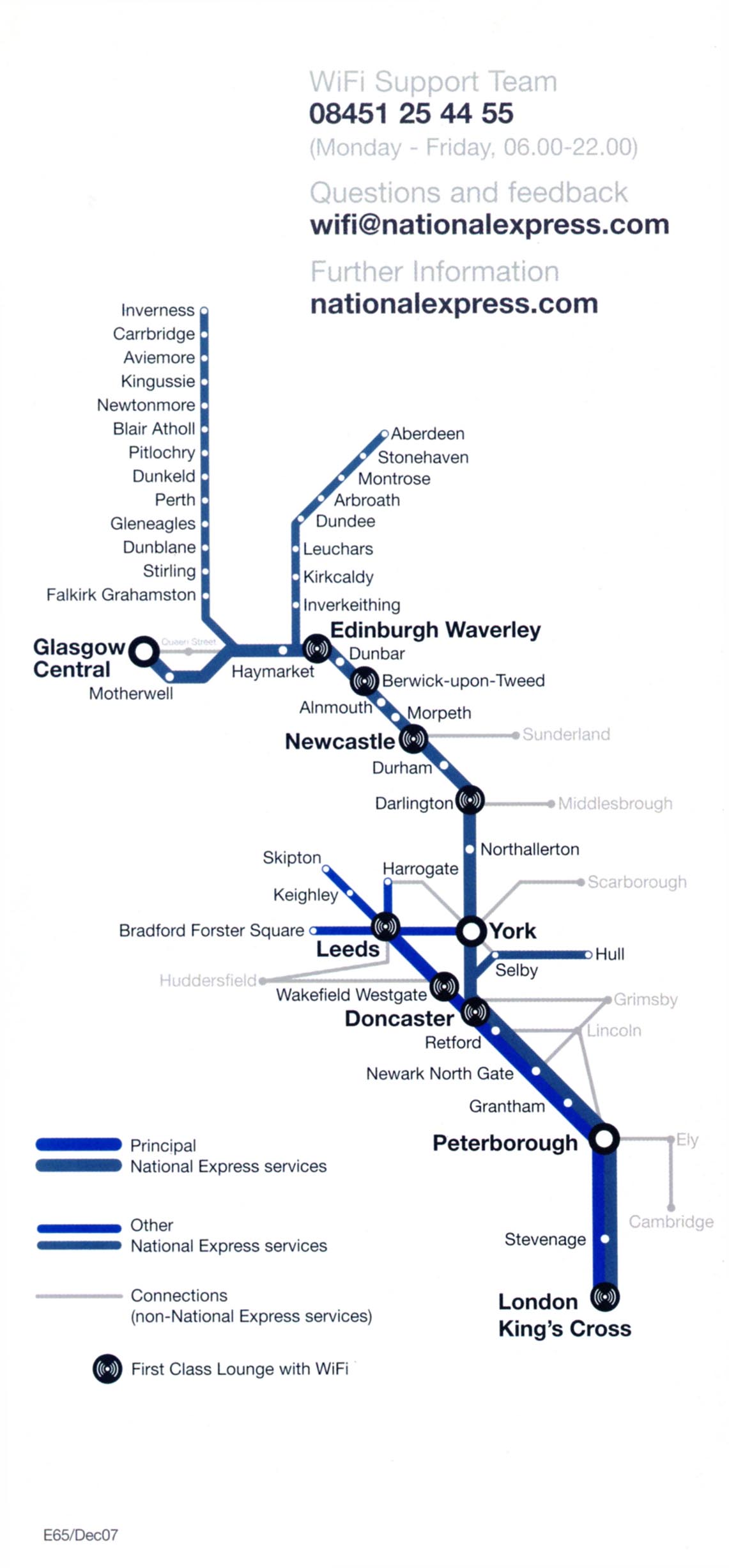
Doesn't explain the grey lines in the key. |
|||||||||||||||||
 |
|||||||||||||||||
 |
 |
 |
|||||||||||||
 |
|||||||||||||||
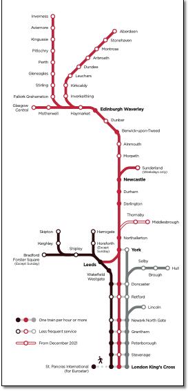
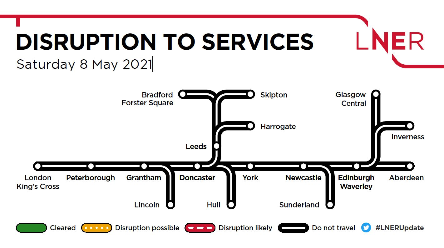
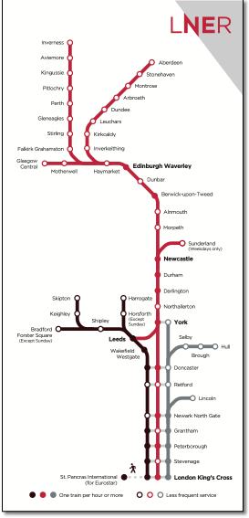
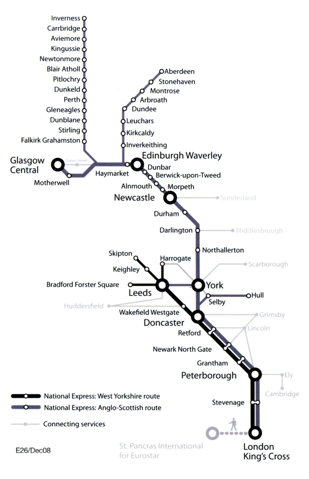
< New east coast franchise operators map doesn't explain the distinction between black, red and grey lines. "One train per hour or more" should be "One train or more per hour". |
|||||||||||||||
 |
|||||||||||||||||||
 |
|||||||||||||||||||
 |
|||||||||||||||||||
.jpg) |
|||||||||||||||||||
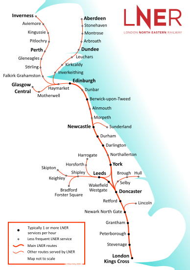
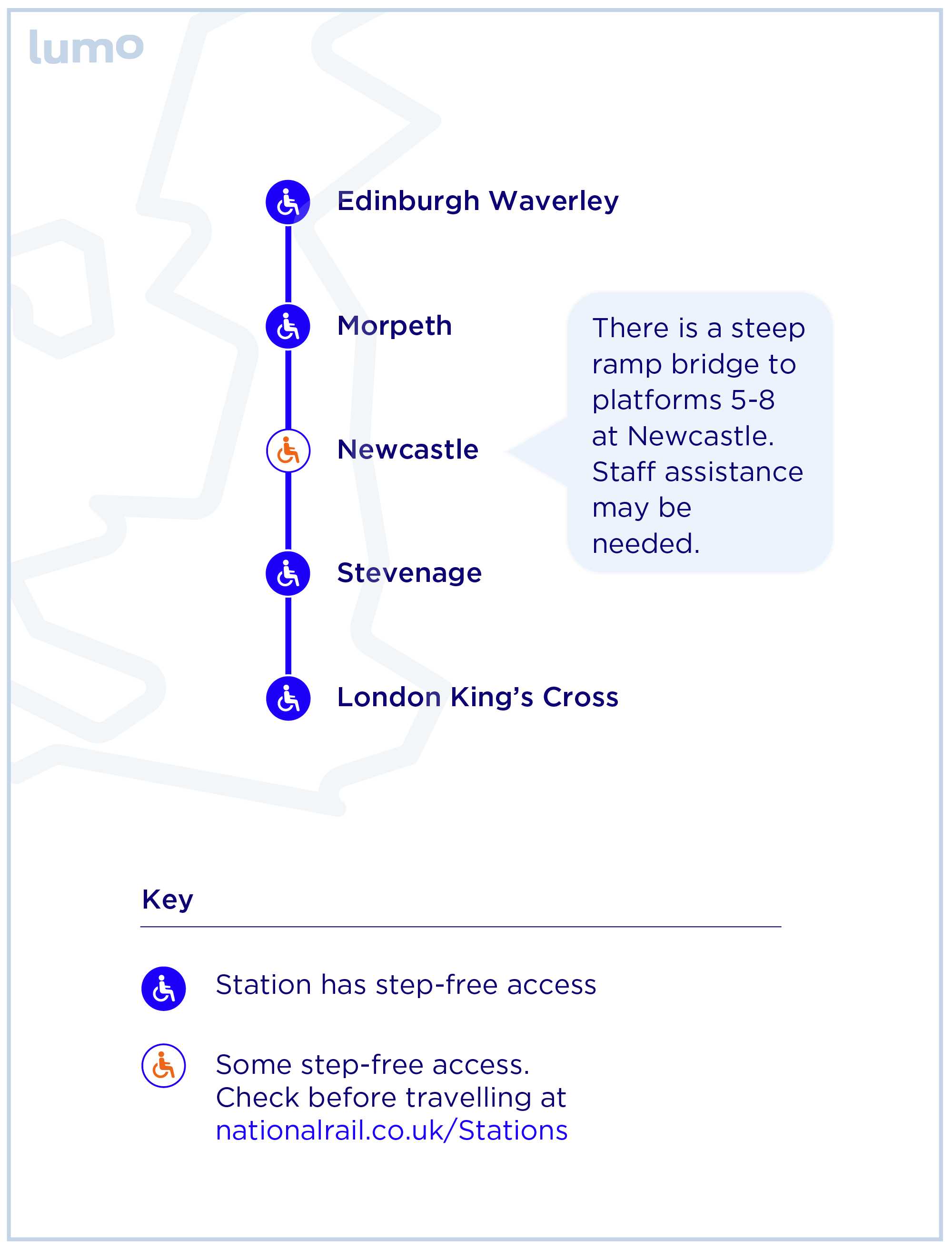
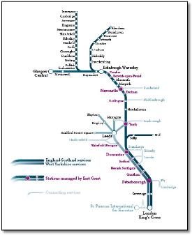
The lines to Inverness and Aberdeen are a darker blue than the main line. |
|||||||||||||||||||
 |
< At last! Something new from the east coast after nine years of the previous version. A straight line all the way from London to Aberdeen, We like it. But why the subtle bends at Motherwell? And does the train from Leeds stop at York, not going any further? Pleased Liverpool is now shown. Very useful. |
||||||||||||||||||
So Lincoln and Leeds are on the main line and Inverness is served from Glasgow? |
|||||||||||||||||||
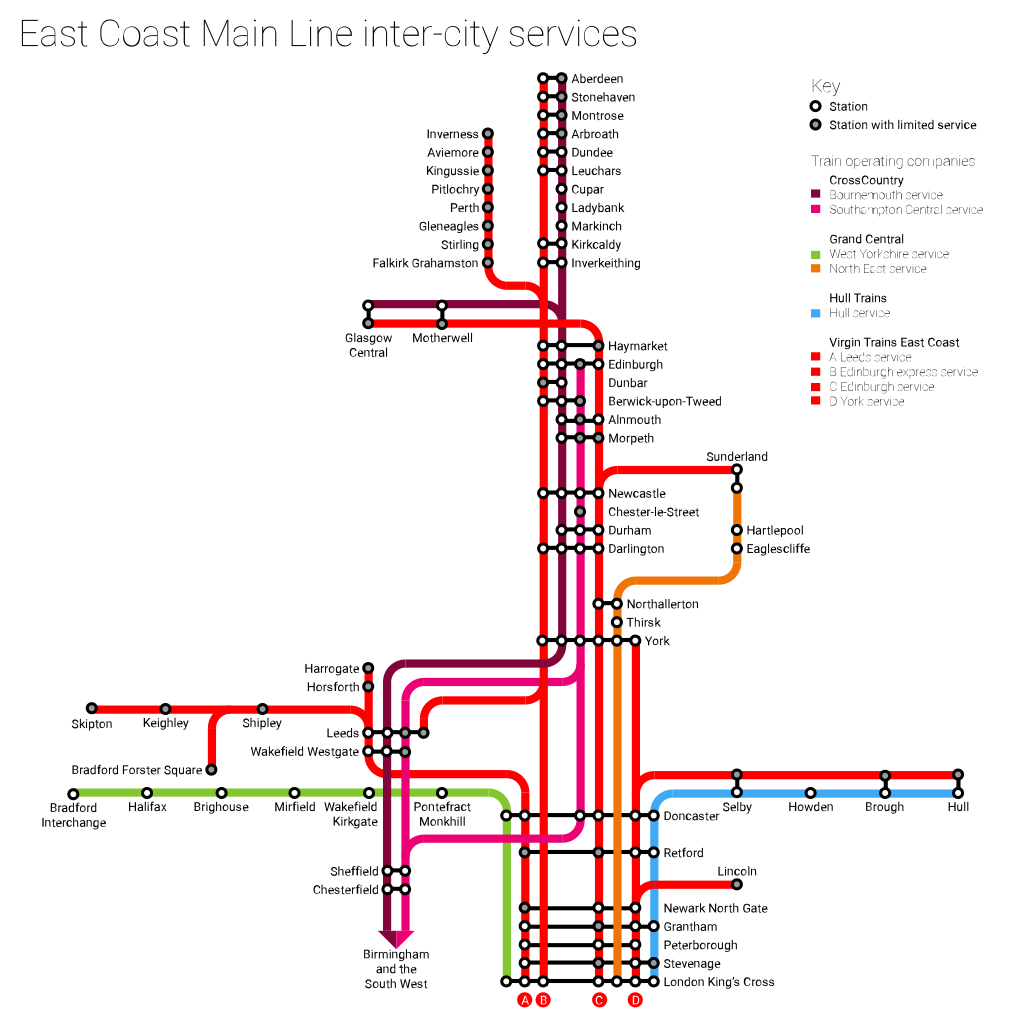
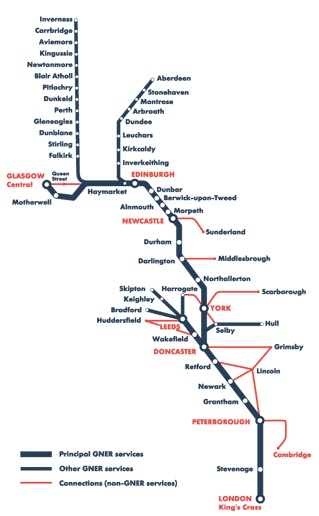
< A return to the old layout. Some graphic designers have got hold of this and added some go-faster stripes. Why the distinction between West Yorkshire and Anglo-Scottish services? Especially as Hull is shown as a Scottish service. And do Lincoln services only connect into Scottish services? And the different shades of blue - why does it get darker on the Inverness and Aberdeen lines? Oh dear. |
|||||||||||||||||||
 |
|||||||||||||||||||
 |
 |
 |
 |
||||||||||||||||||||||||||||||||||||
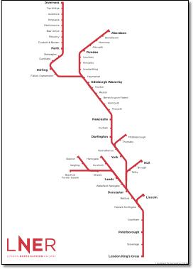
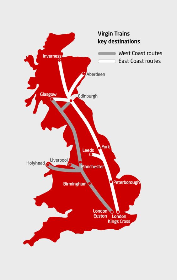
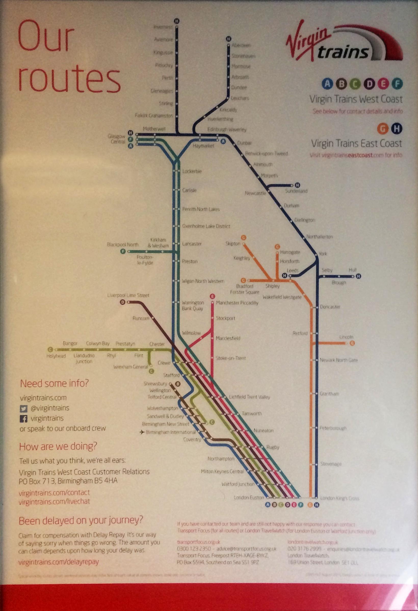
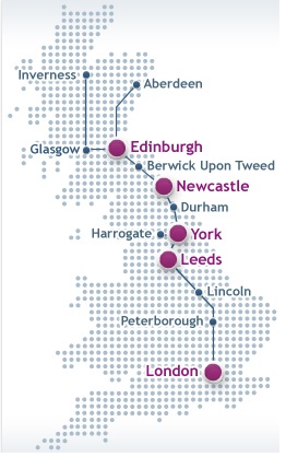
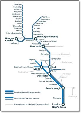
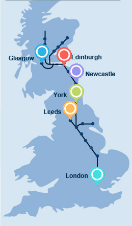
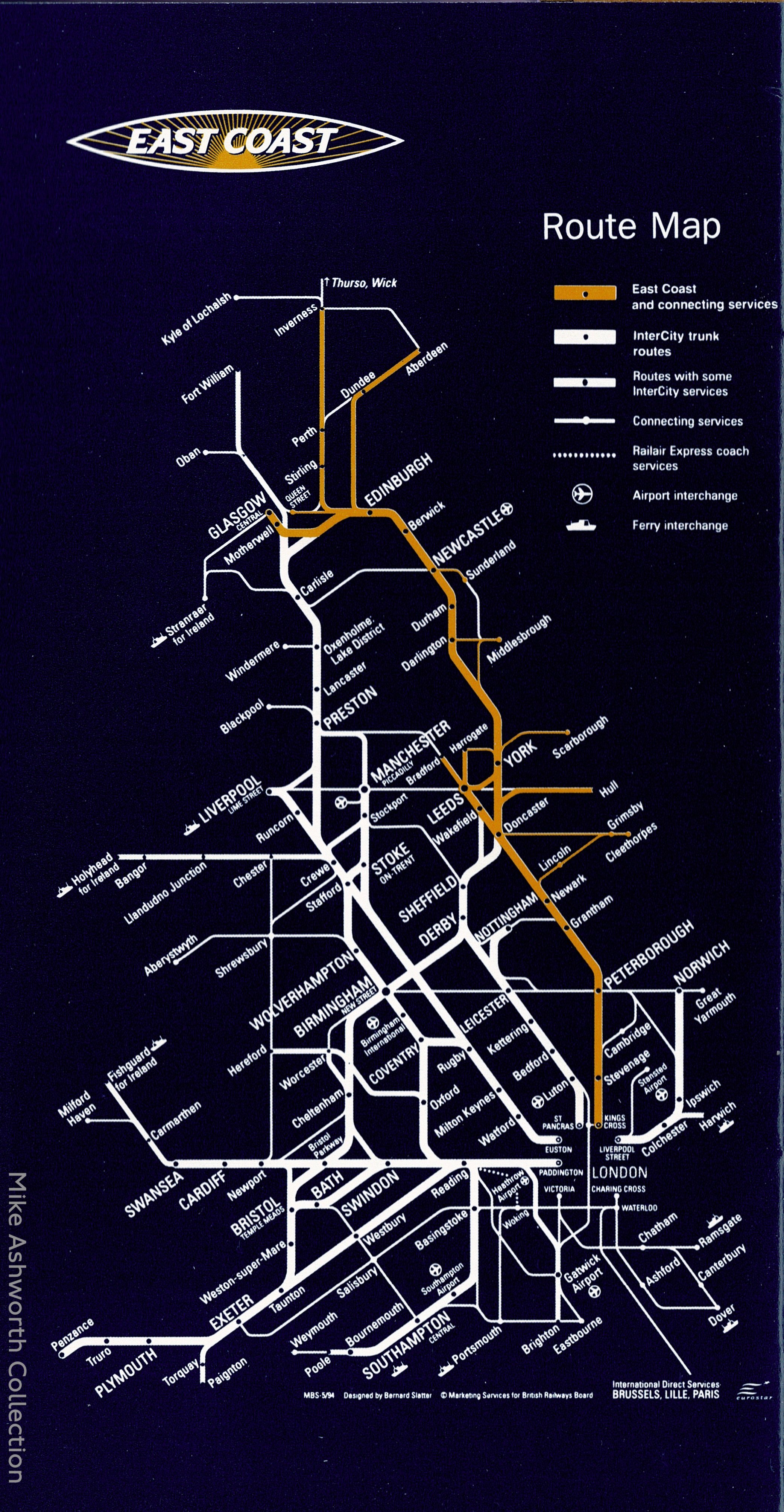
Based on the same design, these four maps mainly vary in how they show the 'connecting lines'. How these connecting lines are selected is unclear, for example why show Harrogate - York or Retford - Lincoln connecting lines but not show lines in north Scotland - and a glaring omission - High Speed 1 to Europe? (Added to latest map.) They also show a non-existent connection between Glasgow Central and Queen Street stations the caption for which is tiny. The recent NatEx map distinguishes routes into two colours although they are not explained. After winning the franchise from GNER in 2007, National Express hasn't bothered to up-date their inherited system map, using unquestioned detail dating back two or three years, and a basic design going back eight. |
|||||||||||||||||||||||||||||||||||||||
 |
|||||||||||||||||||||||||||||||||||||||
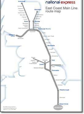
The design is based on the maps dated 2000 (see left) with a schematic route map badly overlaying a geographic outline. This results in Glasgow being shown on the west coast and the Aberdeen route shown not crossing the estuaries of the Forth and Tay. The 2000 maps show Dundee where Perth should be and Skipton and Bradford in Lancashire. |
|||||||||||||||||||||||||||||||||||||||
 |
.jpg) |
.jpg) |
|||||||||||||||||||||||||||||||||||||
.jpg) |
|||||||||||||||||||||||||||||||||||||||
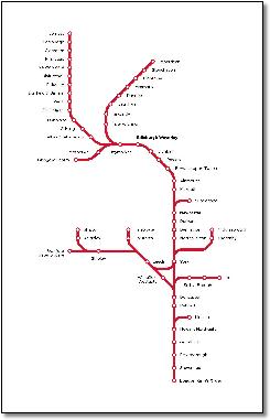
As above, but Flash enabled, Glasgow better, but Inverness line peters out and Aberdeen further south. |
|||||||||||||||||||||||||||||||||||||||
 |
|||||||||||||||||||||||||||||||||||||||
.jpg) |
 |
||||||||||||||||||||||||||||||||||||||
.jpg) |
|||||||||||||||||||||||||||||||||||||||
.jpg) |
|||||||||||||||||||||||||||||||||||||||
 |
|||||||||||||||||||||||||||||||||||||||
.png) |
|||||||||||||||||||||||||||||||||||||||
A mess? All those rail-less bridges etc |
|||||||||||||||||||||||||||||||||||||||