 |
||||||||||||||||
|
|||||
|
|
||||
|
 |
|
|||
|
|||||
|
|||||
|
|||||
 |
||||||||||||||||||||||||
 |
||||||||||||||||||||||||
 |
||||||||||||||||||||||||
 |
 |
|||||||||||||||||||||||
 |
 |
 |
||||||||||||||||||||||
 |
 |
|||||||||||||||||||||||
 |
||||||||||||||||||||||||
 |
||||||||||||||||||||||||
 |
||||||||||||||||||||||||
 |
||||||||||||||||||||||||
 |
||||||||||||||||||||||||
 |
 |
 |
||||
 |
 |
||||||||||||||||||||||||||||||||||||||||||||||||||
 |
|||||||||||||||||||||||||||||||||||||||||||||||||||
 |
|||||||||||||||||||||||||||||||||||||||||||||||||||
 |
|||||||||||||||||||||||||||||||||||||||||||||||||||
 |
 |
||||||||||||||||||||||||||||||||||||||||||||||||||
 |
|||||||||||||||||||||||||||||||||||||||||||||||||||
 |
|||||||||||||||||||||||||||||||||||||||||||||||||||
 |
|||||||||||||||||||||||||||||||||||||||||||||||||||
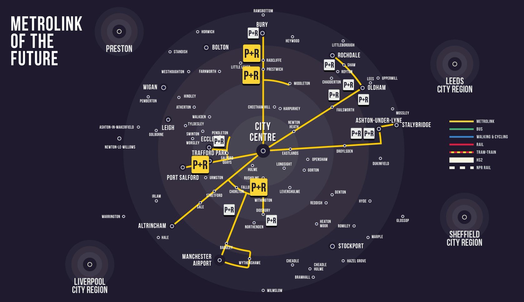
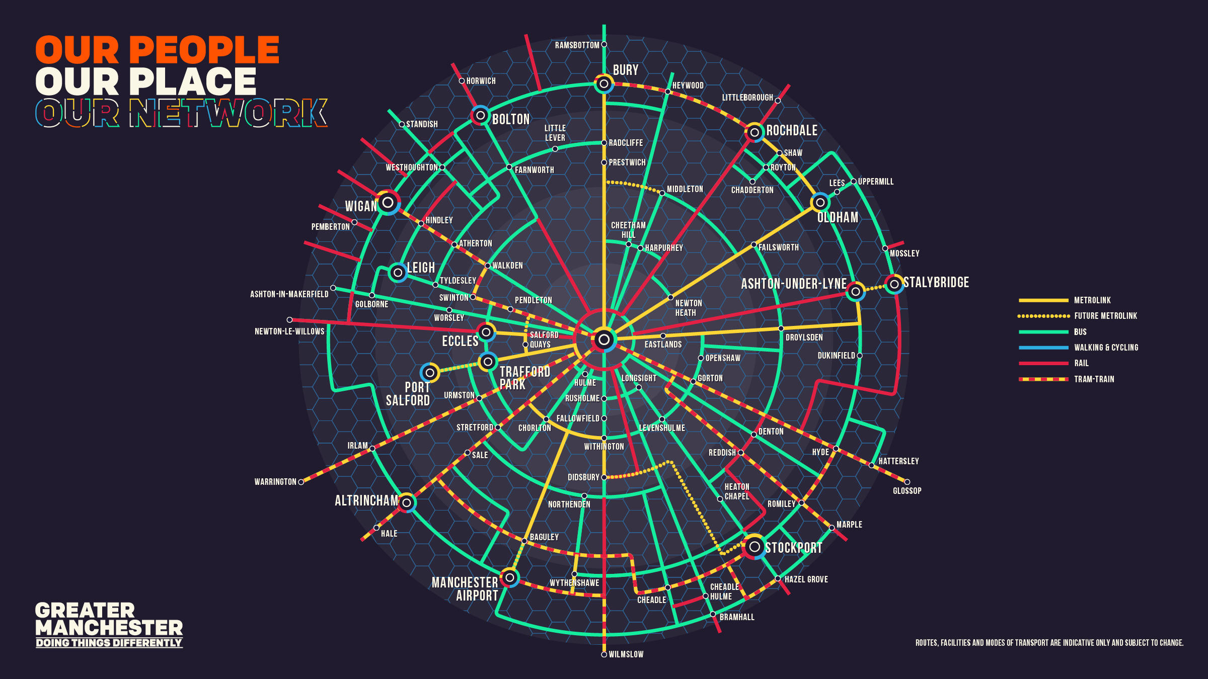
The Master is developing his ideas beyond his circle series. Interesting. But impractical? |
|||||||||||||||||||||||||||||||||||||||||||||||||||
 |
|||||||||||||||||||||||||||||||||||||||||||||||||||
 |
|||||||||||||||||||||||||||||||||||||||||||||||||||
 |
|||||||||||||||||||||||||||||||||||||||||||||||||||
 |
|||||||||||||||||||||||||||||||||||||||||||||||||||
 |
|||||||||||||||||||||||||||||||||||||||||||||||||||
 |
|||||||||||||||||||||||||||||||||||||||||||||||||||
 |
|||||||||||||||||||||||||||||||||||||||||||||||||||
 |
|||||||||||||||||||||||||||||||||||||||||||||||||||
Now with second city crossing shown open. |
|||||||||||||||||||||||||||||||||||||||||||||||||||
 |
|||||||||||||||||||||||||||||||||||||||||||||||||||
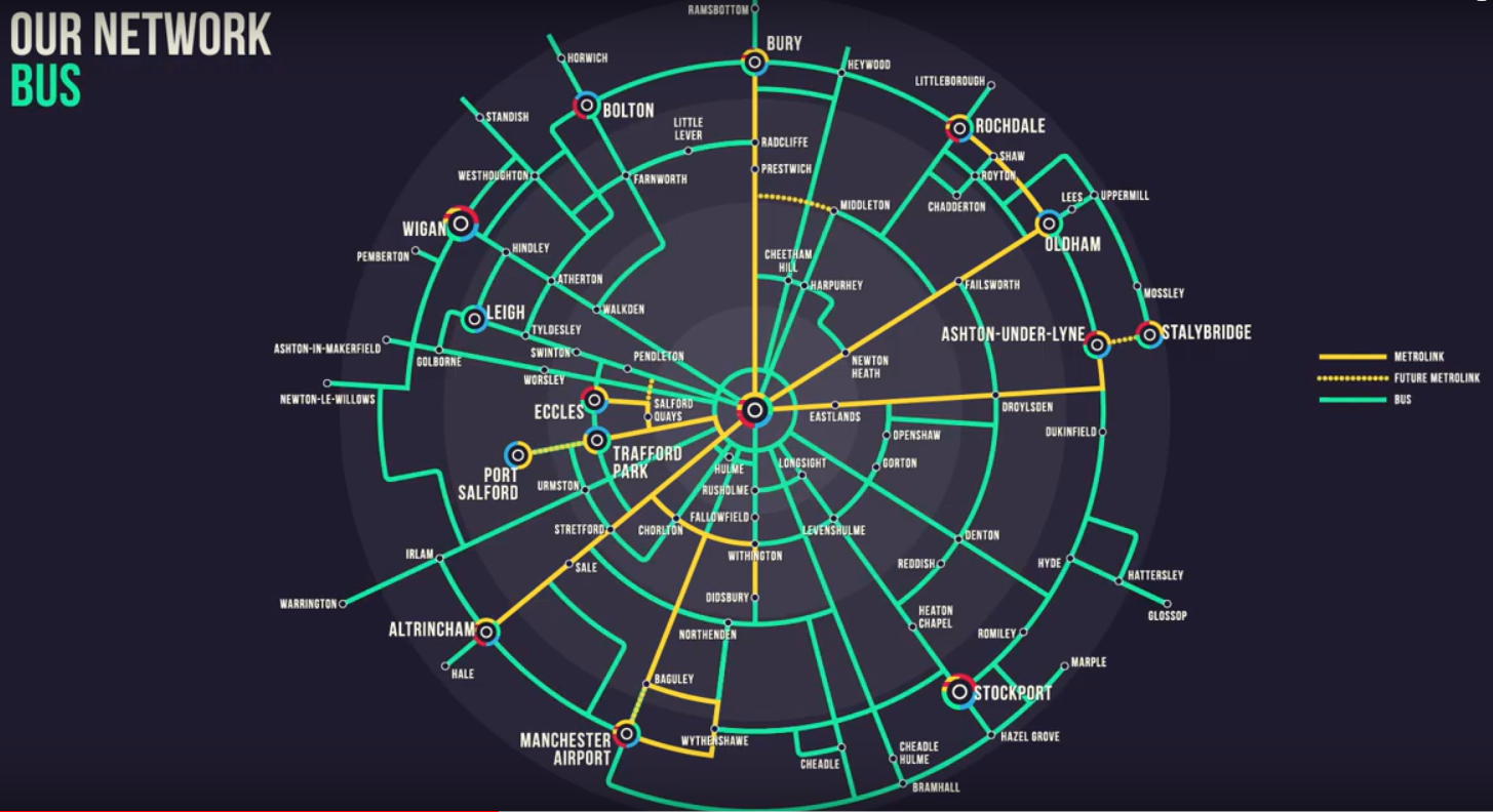
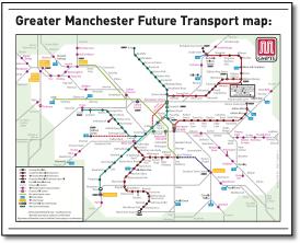
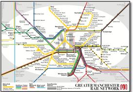
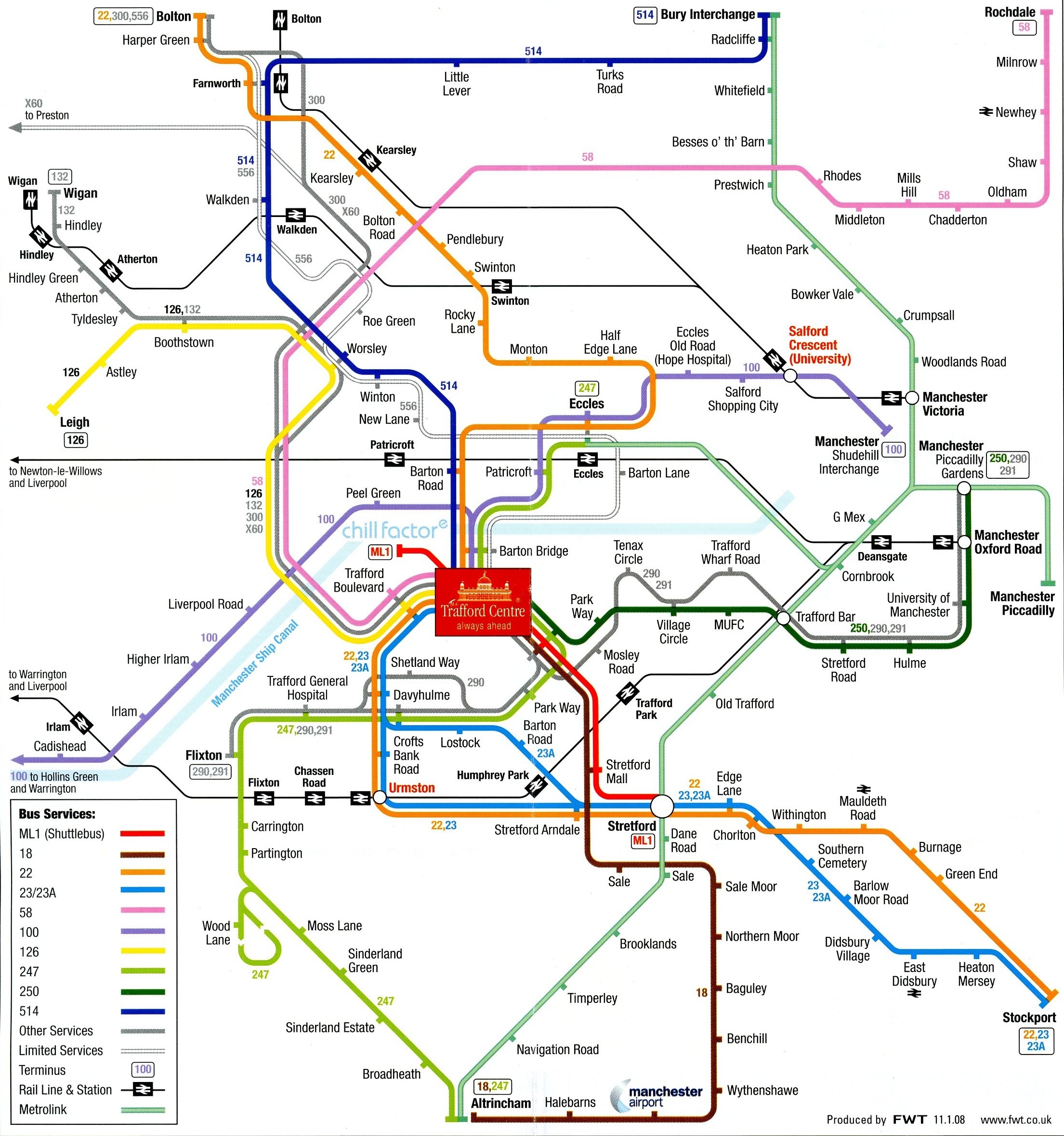
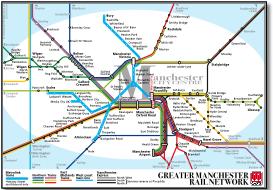
This map features in the centre spread of the multipage A4 public consultation document issued to all homes in the GMPTE area in summer of 2008. Based on the existing rail map, proposed bus and metrolink routes are superimposed without consideration of the overall appearance. Considering GMPTE want the public to support congestion charging (to support the £3b public transport TIF initiative), this is a pretty poor way of campaigning for support. |
|||||||||||||||||||||||||||||||||||||||||||||||||||
 |
|||||||||||||||||||||||||||||||||||||||||||||||||||
Now with Trafford Centre extension. |
|||||||||||||||||||||||||||||||||||||||||||||||||||
 |
|||||||||||||||||||||||||||||||||||||||||||||||||||
 |
|||||||||||||||||||||||||||||||||||||||||||||||||||
 |
|||||||||||||||||||||||||||||||||||||||||||||||||||
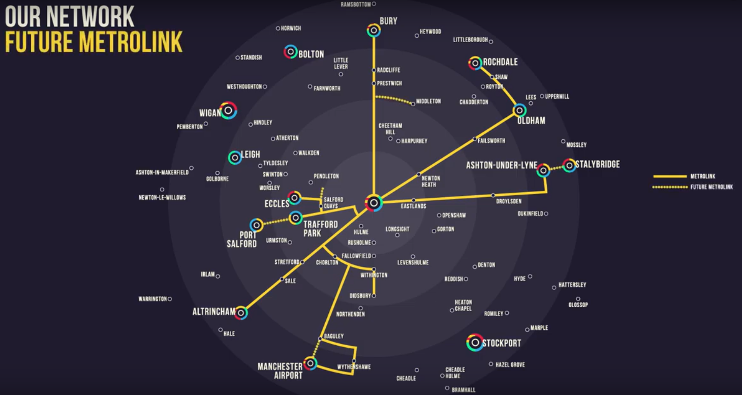
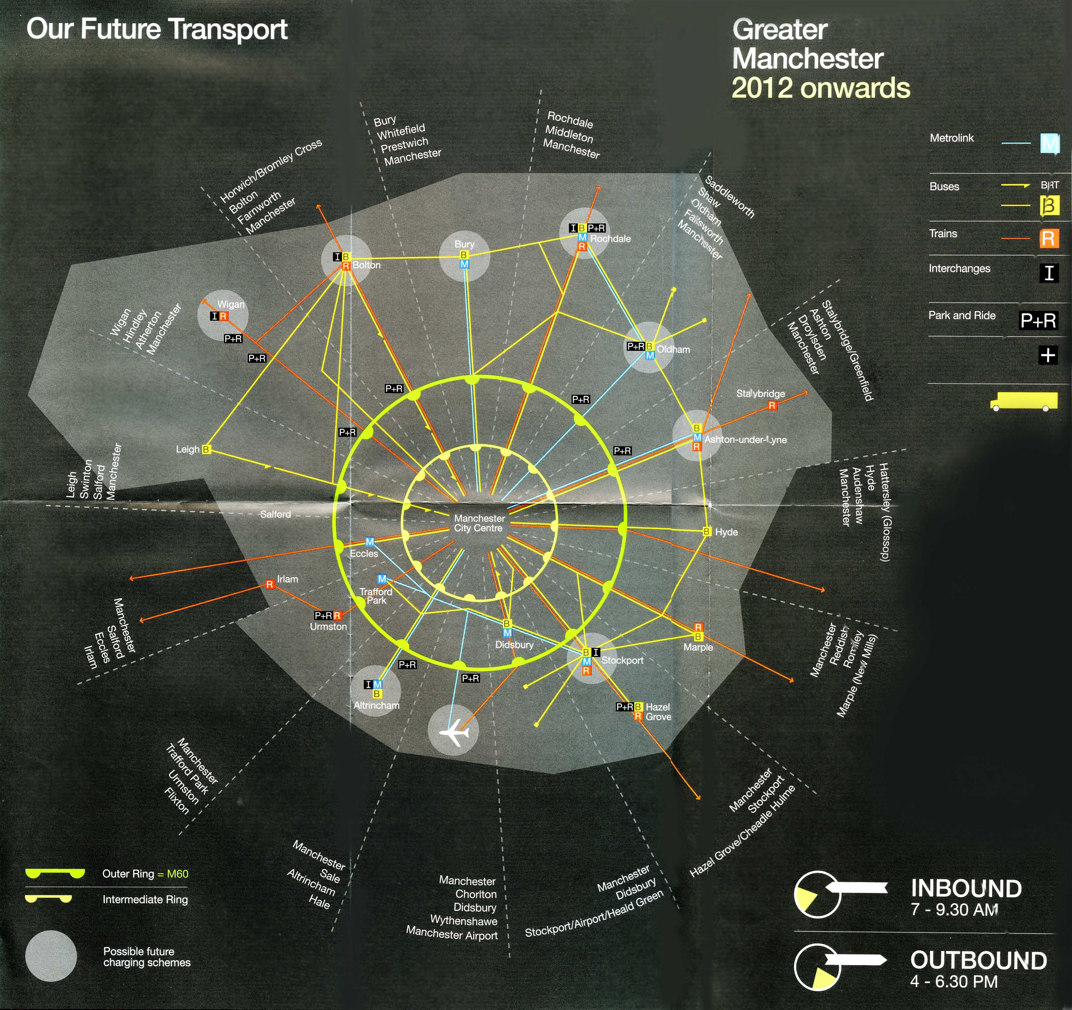
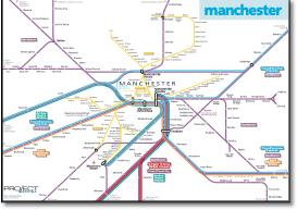
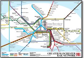
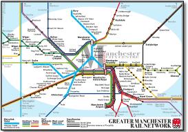
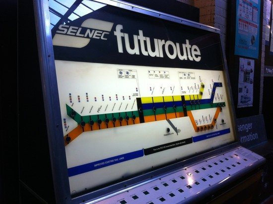
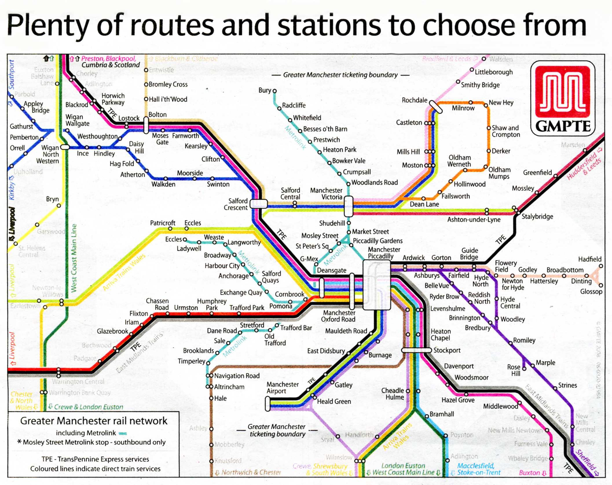
This map features in a leaflet distributed earlier in 2008. A great bit of graphic design, with a lot of energy input by someone with clear graphic design skills - but is its meaning clear? Apologise for bad scan and retouching. |
|||||||||||||||||||||||||||||||||||||||||||||||||||
 |
|||||||||||||||||||||||||||||||||||||||||||||||||||
 |
|||||||||||||||||||||||||||||||||||||||||||||||||||
1.jpg) |
|||||||||||||||||||||||||||||||||||||||||||||||||||
 |
|||||||||||||||||||||||||||||||||||||||||||||||||||
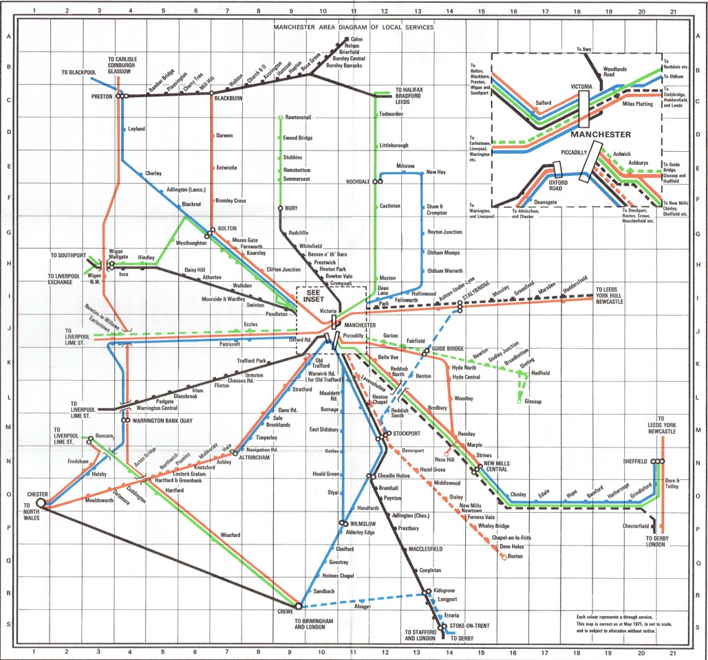
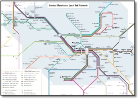
Horrible at Styal. |
|||||||||||||||||||||||||||||||||||||||||||||||||||
 |
|||||||||||||||||||||||||||||||||||||||||||||||||||
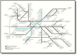
It may not be possible to update this map to include the Metrolink extension to the Airport, the second city crossing or to the Trafford Centre. |
|||||||||||||||||||||||||||||||||||||||||||||||||||
Perhaps this is where the map above came from? |
|||||||||||||||||||||||||||||||||||||||||||||||||||
 |
|||||||||||||||||||||||||||||||||||||||||||||||||||
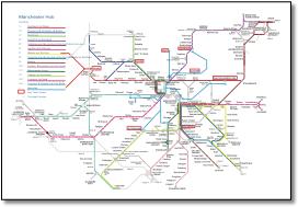
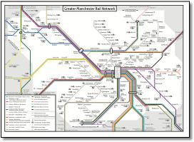
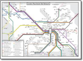
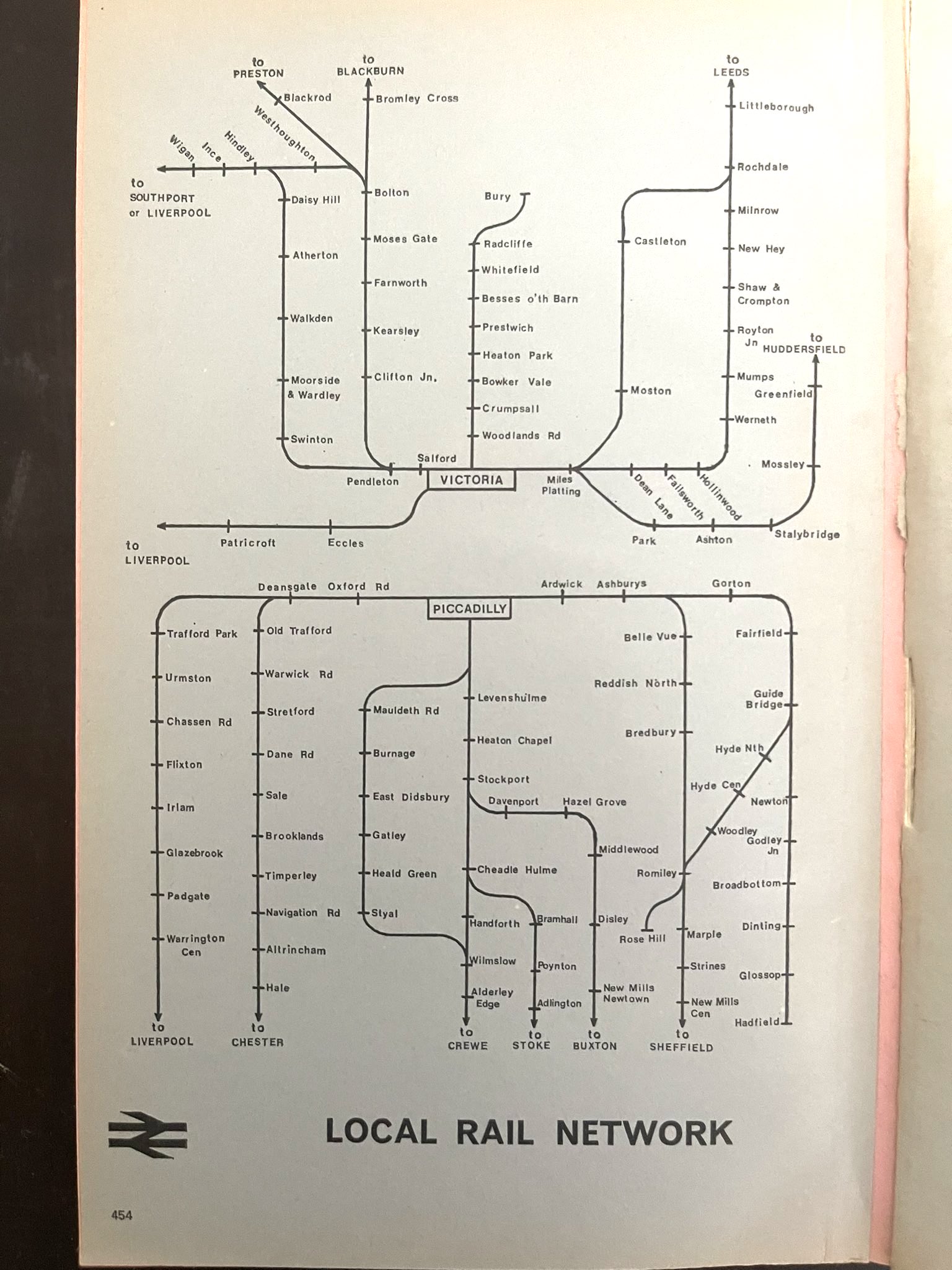
A compact version of those below for A6 booklet with superfluous detail removed. Adds kinks to the WCML and at Salford Crescent, presumably to accomodate larger station names around Bolton. |
|||||||||||||||||||||||||||||||||||||||||||||||||||
 |
|||||||||||||||||||||||||||||||||||||||||||||||||||
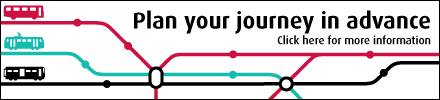
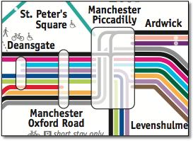
This banner seems to use different symbolism - different line weights and station symbols to its main maps. Very subtle difference in the symbol used to describe a bus, a tram and a train. |
|||||||||||||||||||||||||||||||||||||||||||||||||||
 |
|||||||||||||||||||||||||||||||||||||||||||||||||||
 |
|||||||||||||||||||||||||||||||||||||||||||||||||||
 |
|||||||||||||||||||||||||||||||||||||||||||||||||||
 |
|||||||||||||||||||||||||||||||||||||||||||||||||||
 |
|||||||||||||||||||||||||||||||||||||||||||||||||||
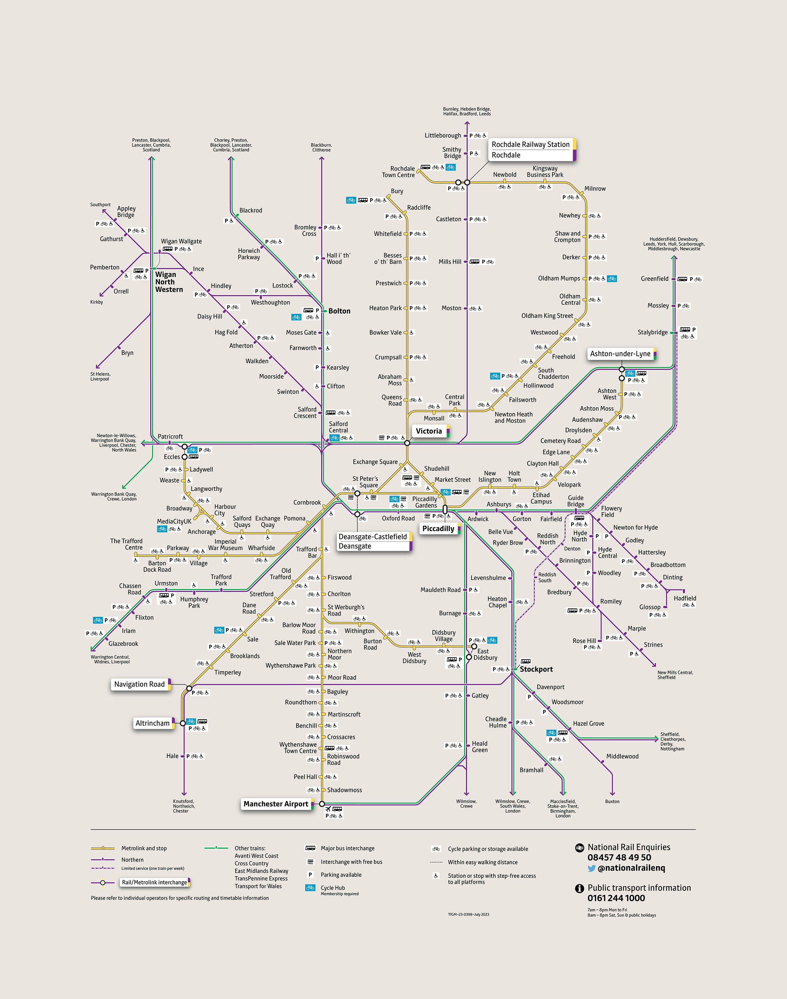
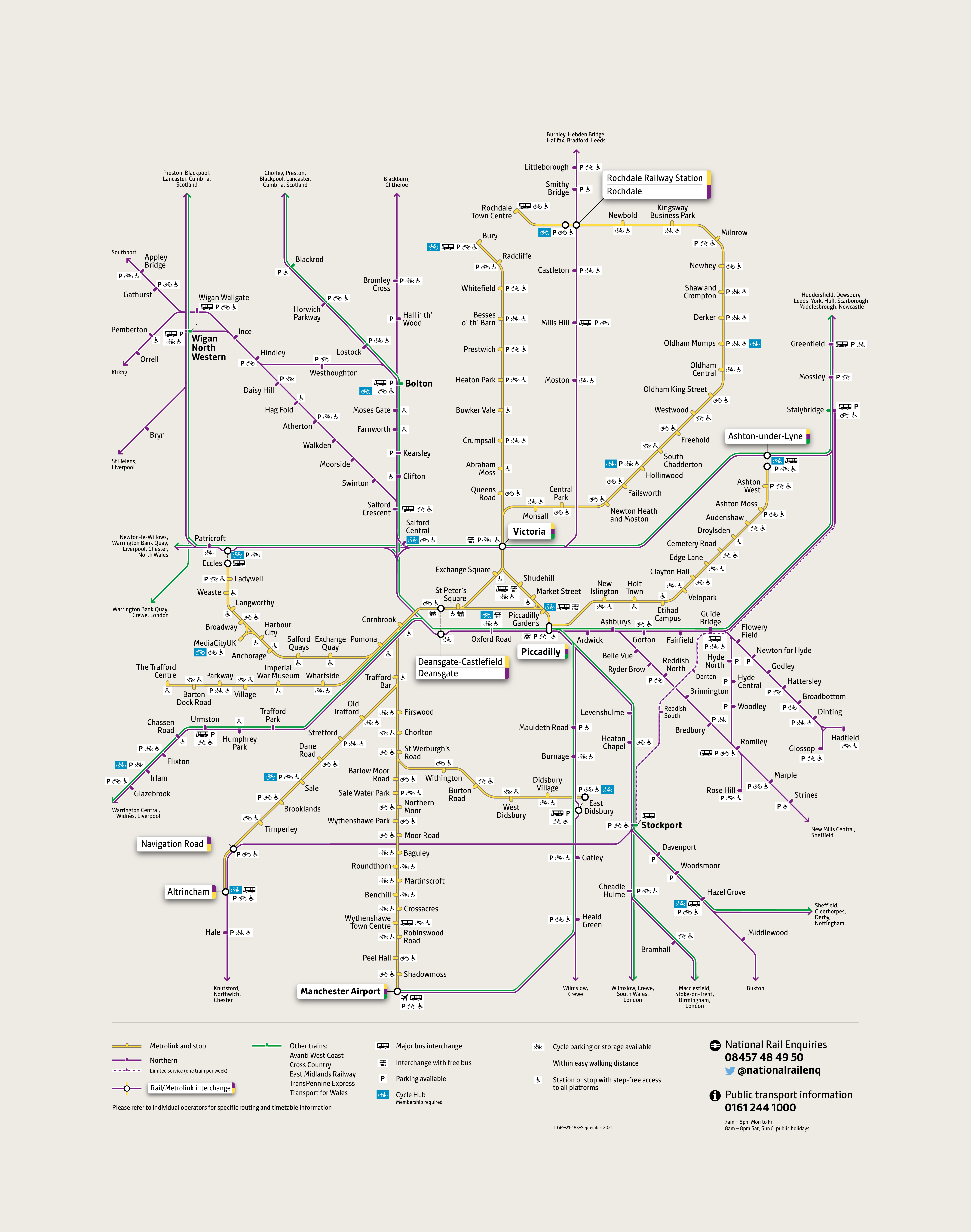
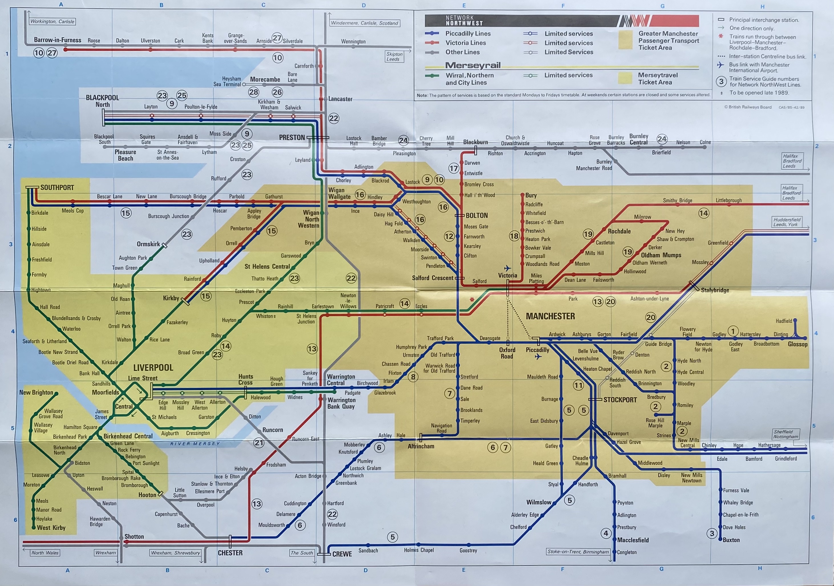
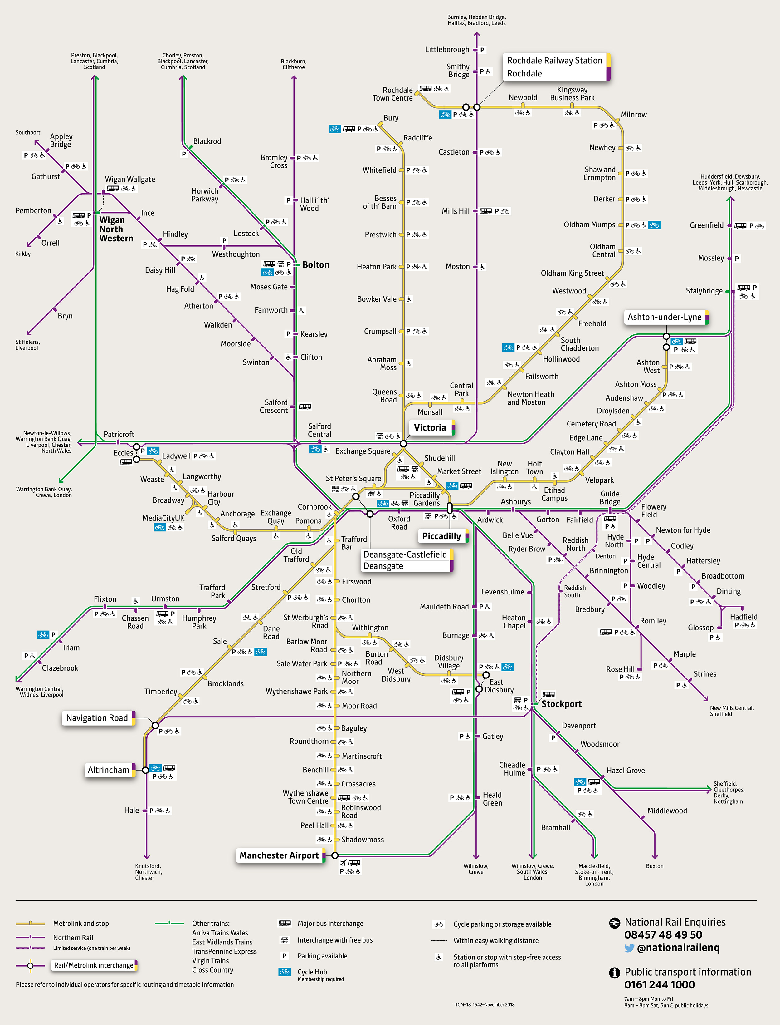
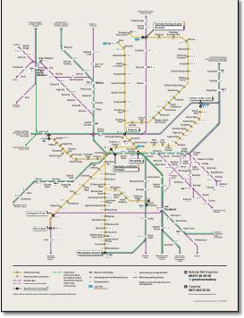
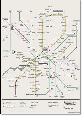
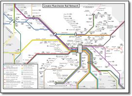
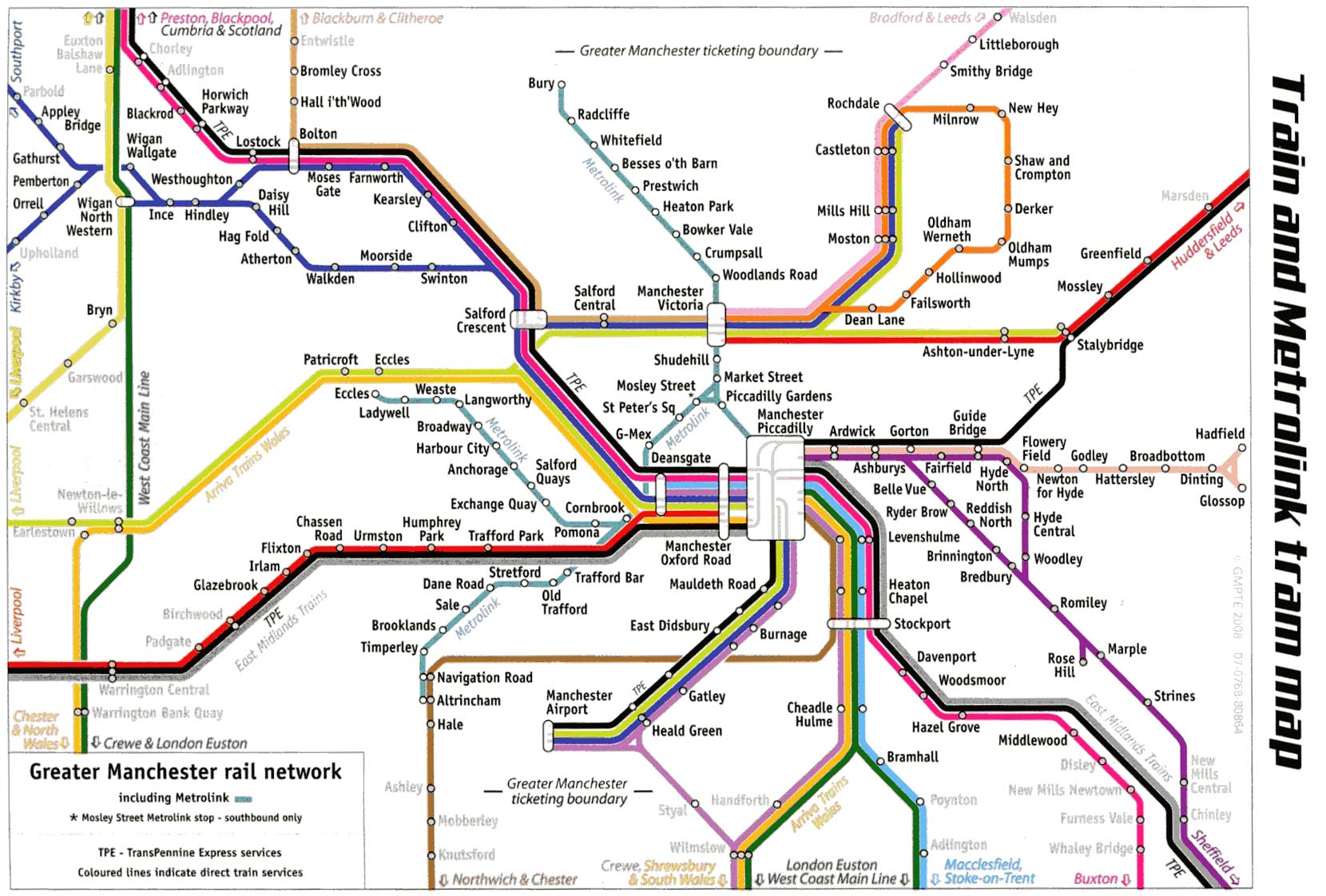
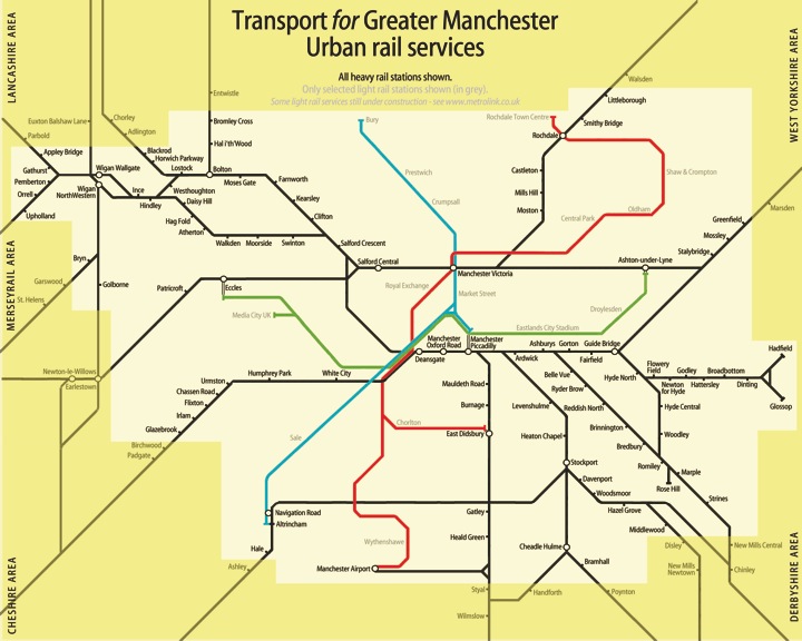
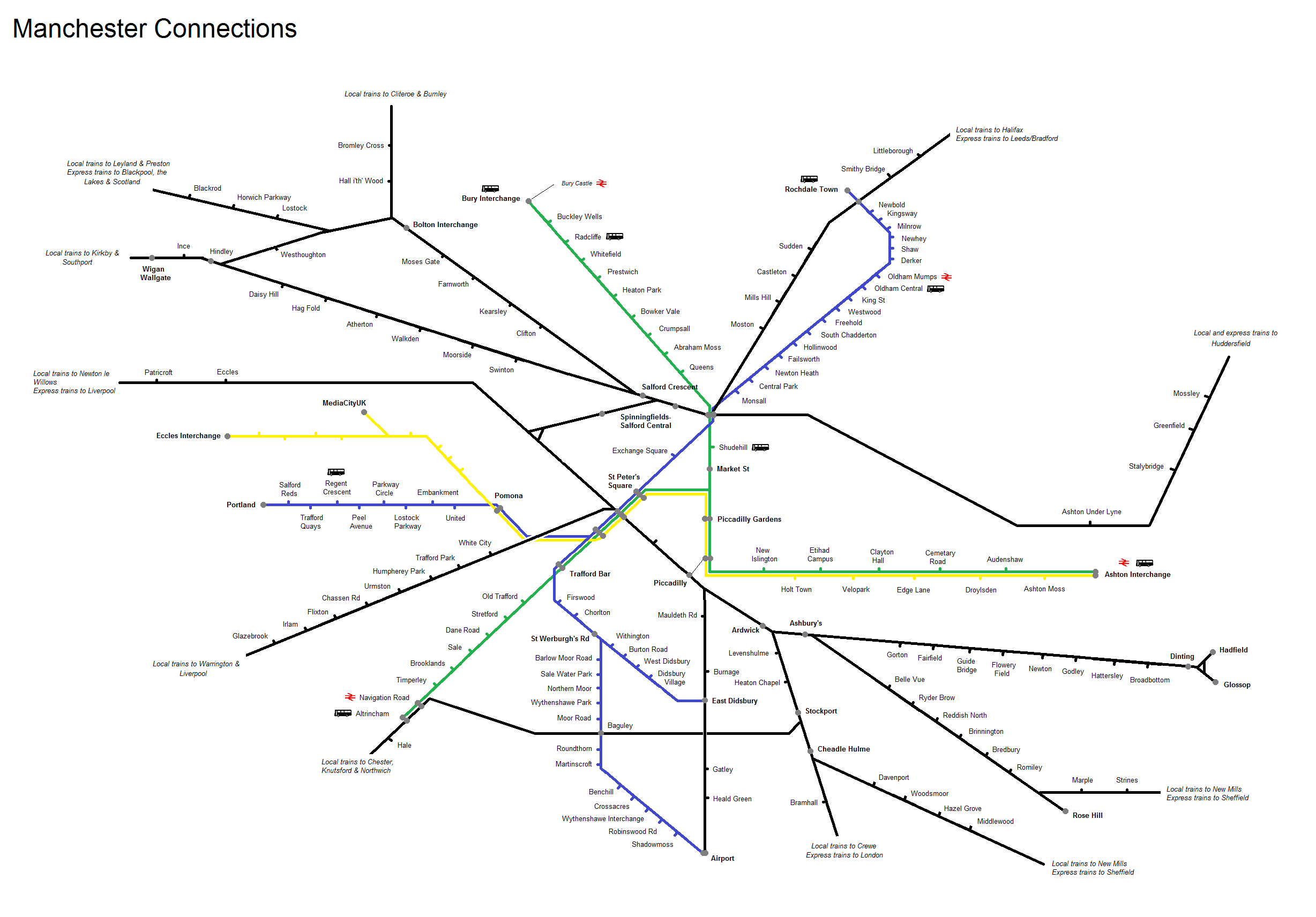
Launched in a blaze of publicity in November 2007 as a 'London tube style' map Many faults were identified and featured in Rail Magazine 'letters to the editor' to which GMPTE replied with the usual platitudes. These were as follows and have largely been subsequently corrected, without acknowledgement, as identified below. 1 Doesn't show the Central Trains Liverpool - Norwich service or the Stalybridge - Liverpool stopping service. Corrected |
|||||||||||||||||||||||||||||||||||||||||||||||||||
 |
|||||||||||||||||||||||||||||||||||||||||||||||||||
Added Metrolink south Manchester line. |
|||||||||||||||||||||||||||||||||||||||||||||||||||
 |
|||||||||||||||||||||||||||||||||||||||||||||||||||
 |
|||||||||||||||||||||||||||||||||||||||||||||||||||
Added Media City UK and renamed Deansgate-Castlefield. |
|||||||||||||||||||||||||||||||||||||||||||||||||||
 |
|||||||||||||||||||||||||||||||||||||||||||||||||||
 |
|||||||||||||||||||||||||||||||||||||||||||||||||||
 |
|||||||||||||||||||||||||||||||||||||||||||||||||||
Oldham loop removed. |
|||||||||||||||||||||||||||||||||||||||||||||||||||
 |
|||||||||||||||||||||||||||||||||||||||||||||||||||
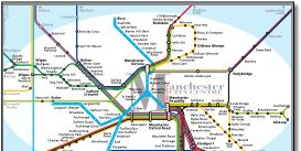
for example shows Metrolink going under CLC with a distinct ‘bridge’ graphic whereas it goes over. Still doesn't say whether large stations with ghosted content are interchange or major. Whereas one is unlikely to change trains at Manchester Airport, one is at Stalybridge. The 2008 version has added the Arriva Trains Wales to south Wales and WCML south of Piccadilly which add no additional direct services although it does identify additional operators. Is it worth making the key even more complex with 19 colours for that subtle benefit? |
|||||||||||||||||||||||||||||||||||||||||||||||||||
 |
|||||||||||||||||||||||||||||||||||||||||||||||||||
 |
 |
||||||||||||||||||||||||||||||||||||||||||||||||||
 |
|||||||||||||||||||||||||||||||||||||||||||||||||||
 |
|||||||||||||||||||||||||||||||||||||||||||||||||||
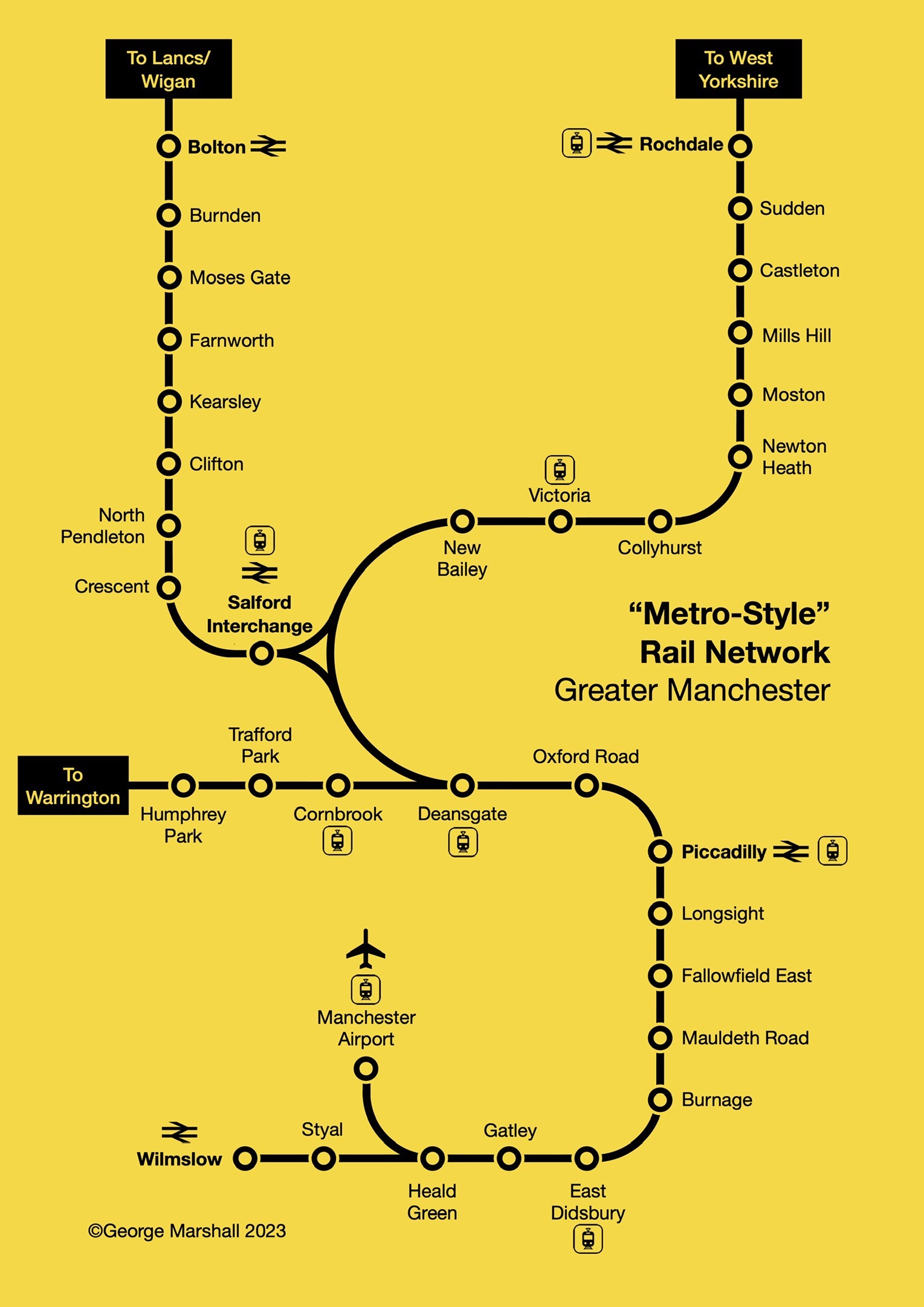
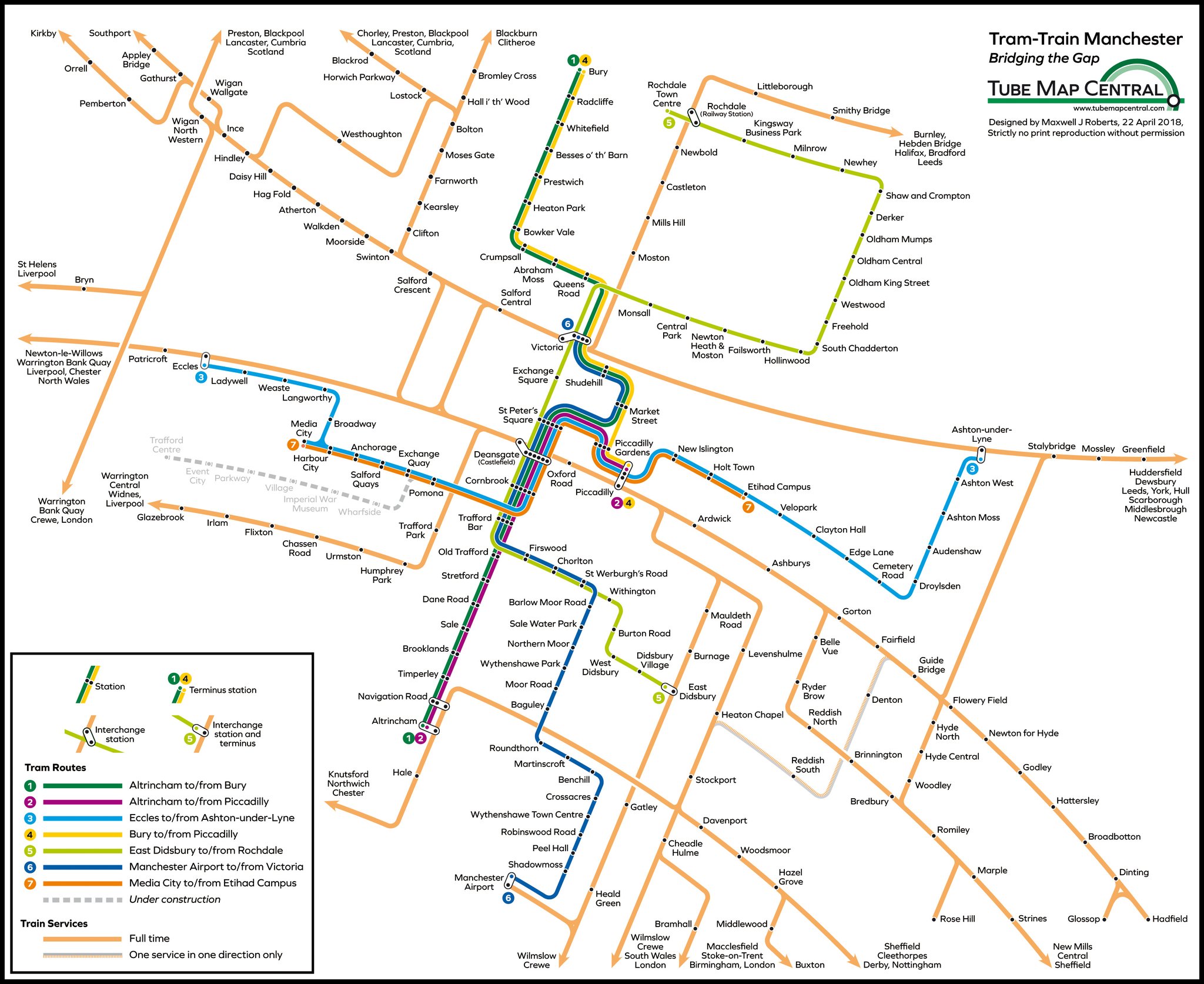
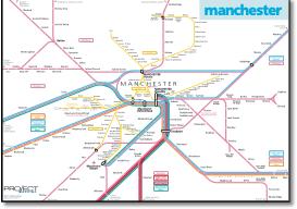
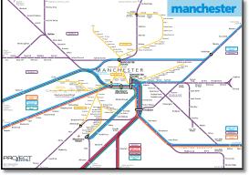
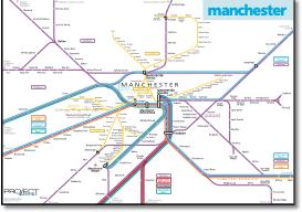
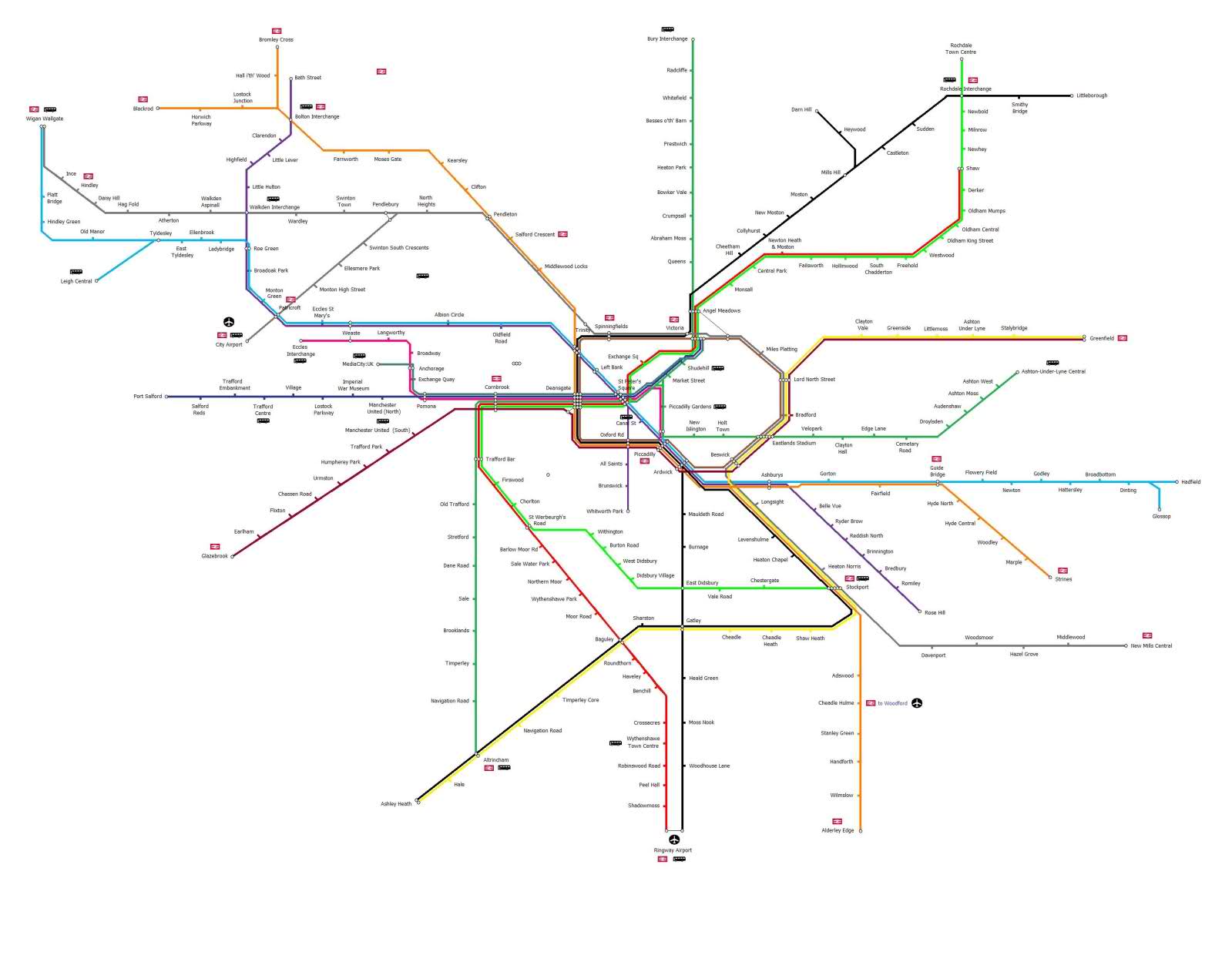
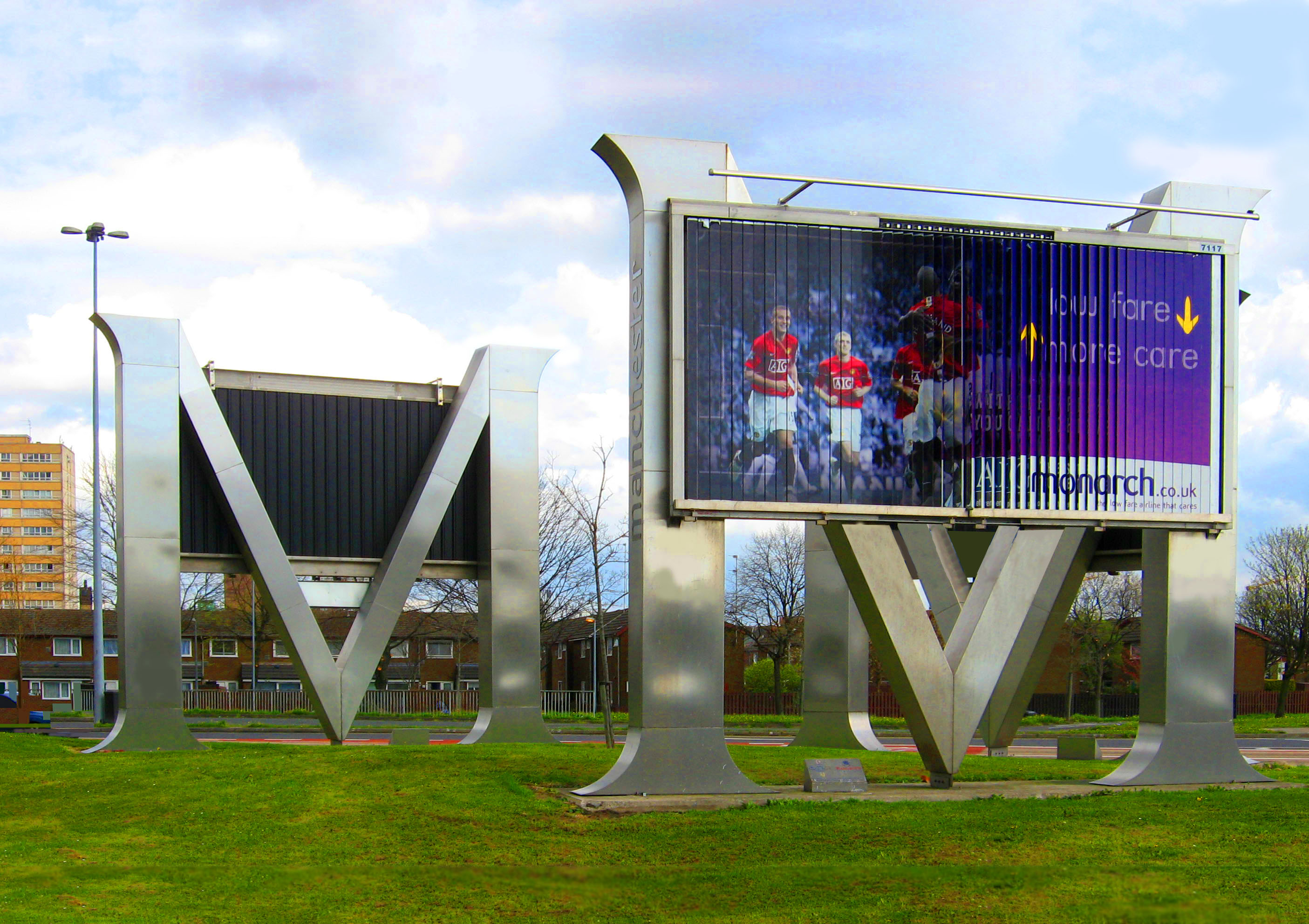
Project Mapping version 1 Manchester city centre is centrally placed on the map. Using the ‘M’, as seen entering Manchester on many roads, adds character and identity to the map. But will have to consider multiple operators (for example ATW and Virgin as well as Northern south of Piccadilly). |
|||||||||||||||||||||||||||||||||||||||||||||||||||
 |
|||||||||||||||||||||||||||||||||||||||||||||||||||
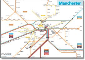
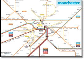
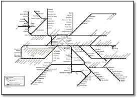
A simplified version of above maps seen in Manchester Evening News December 2008. |
|||||||||||||||||||||||||||||||||||||||||||||||||||
|
|||||||||||||||||||||||||||||||||||||||||||||||||||
 |
|||||||||||||||||||||||||||||||||||||||||||||||||||
 |
|||||||||||||||||||||||||||||||||||||||||||||||||||
 |
|||||||||||||||||||||||||||||||||||||||||||||||||||
 |
|||||||||||||||||||||||||||||||||||||||||||||||||||
.jpg) |
|||||||||||||||||||||||||||||||||||||||||||||||||||
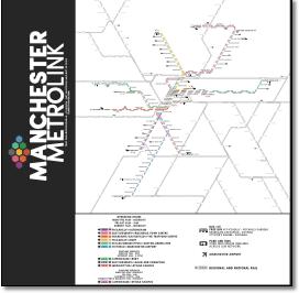
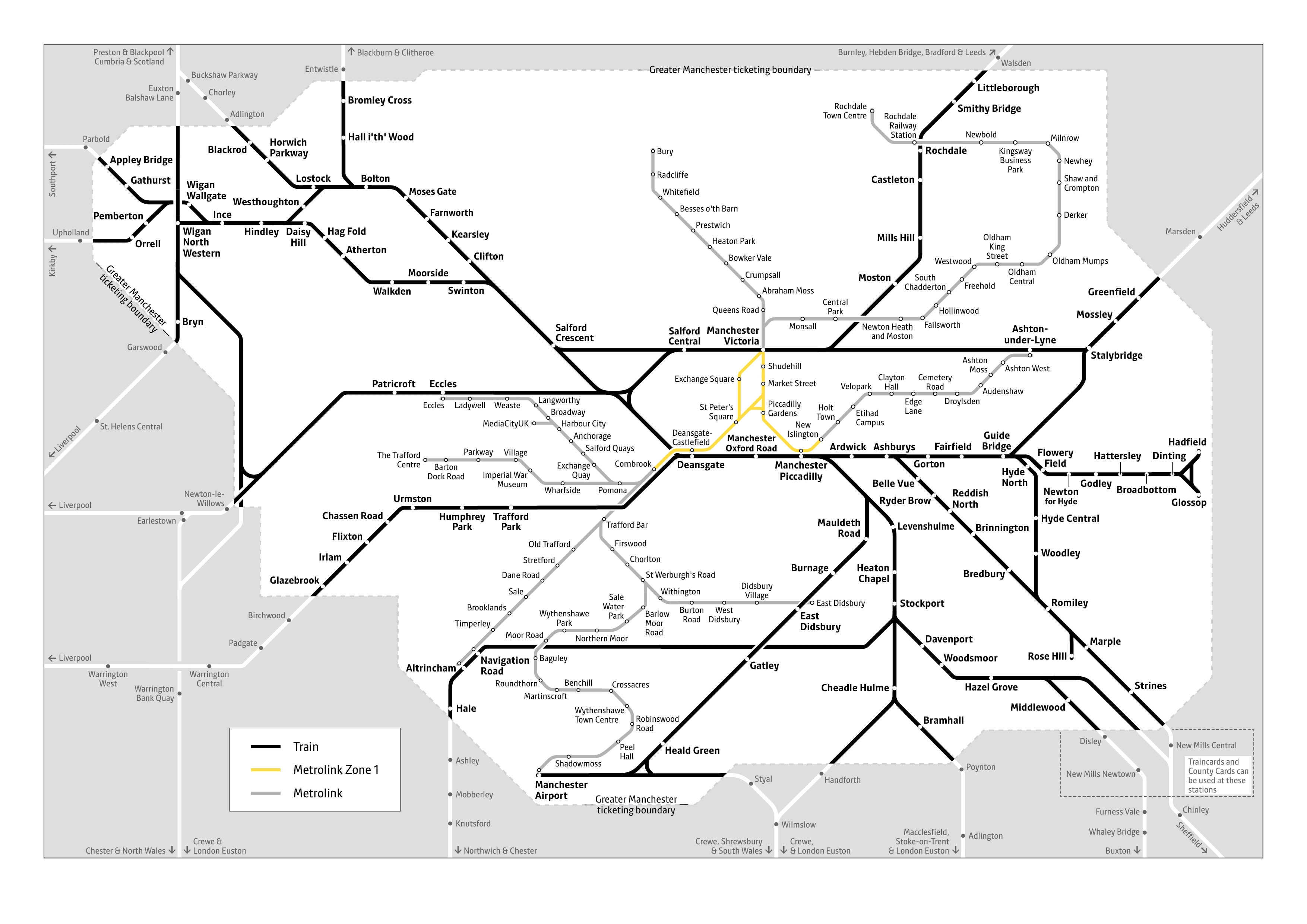
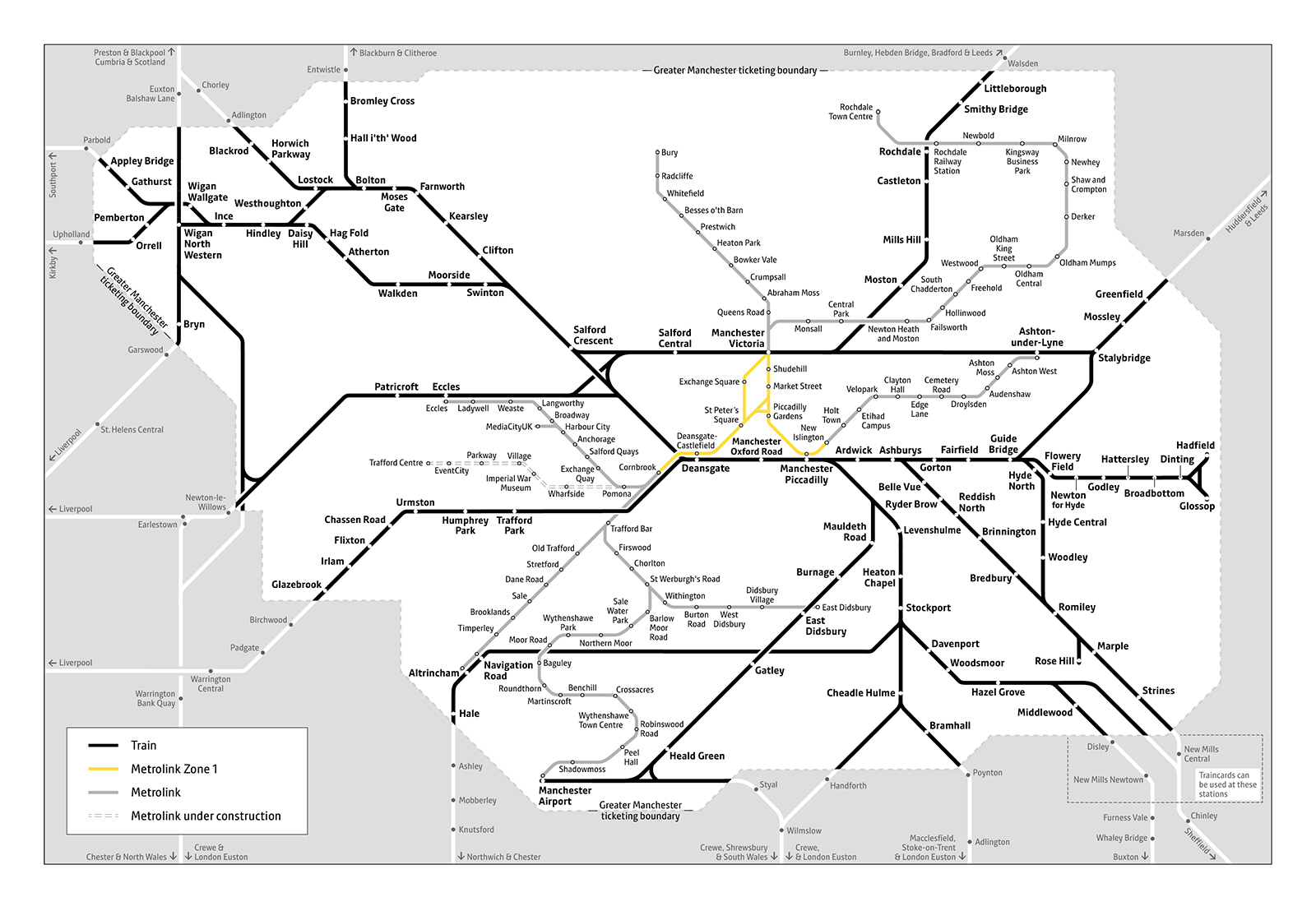
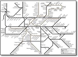
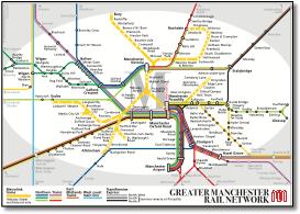
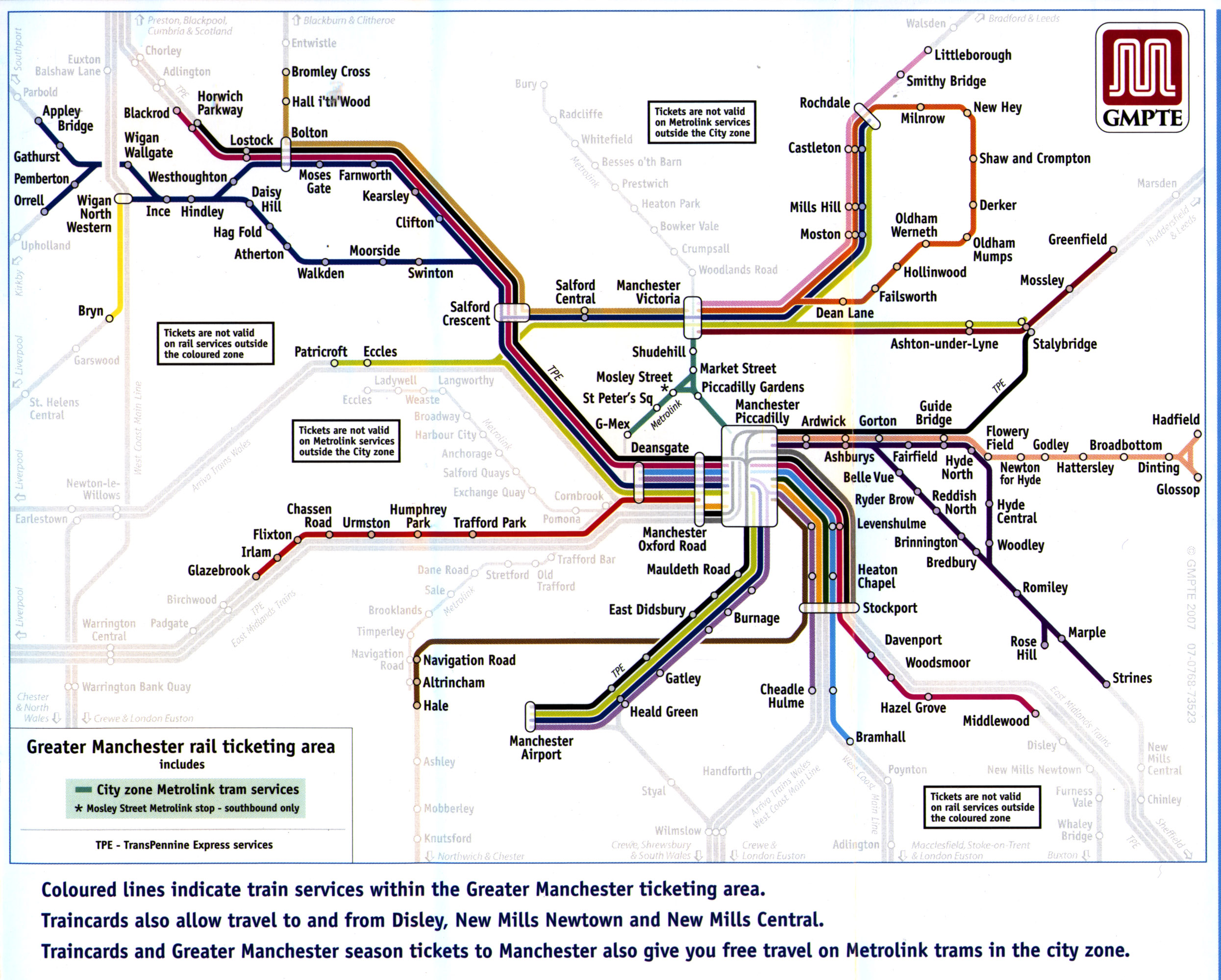
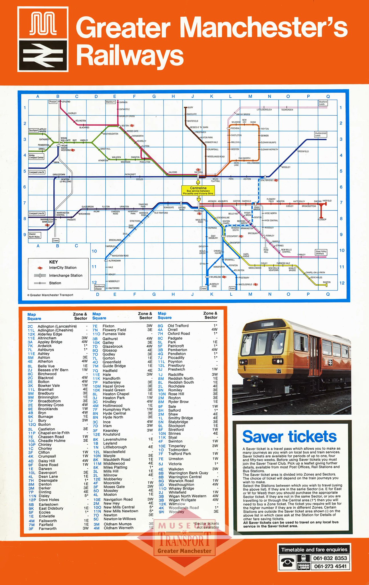
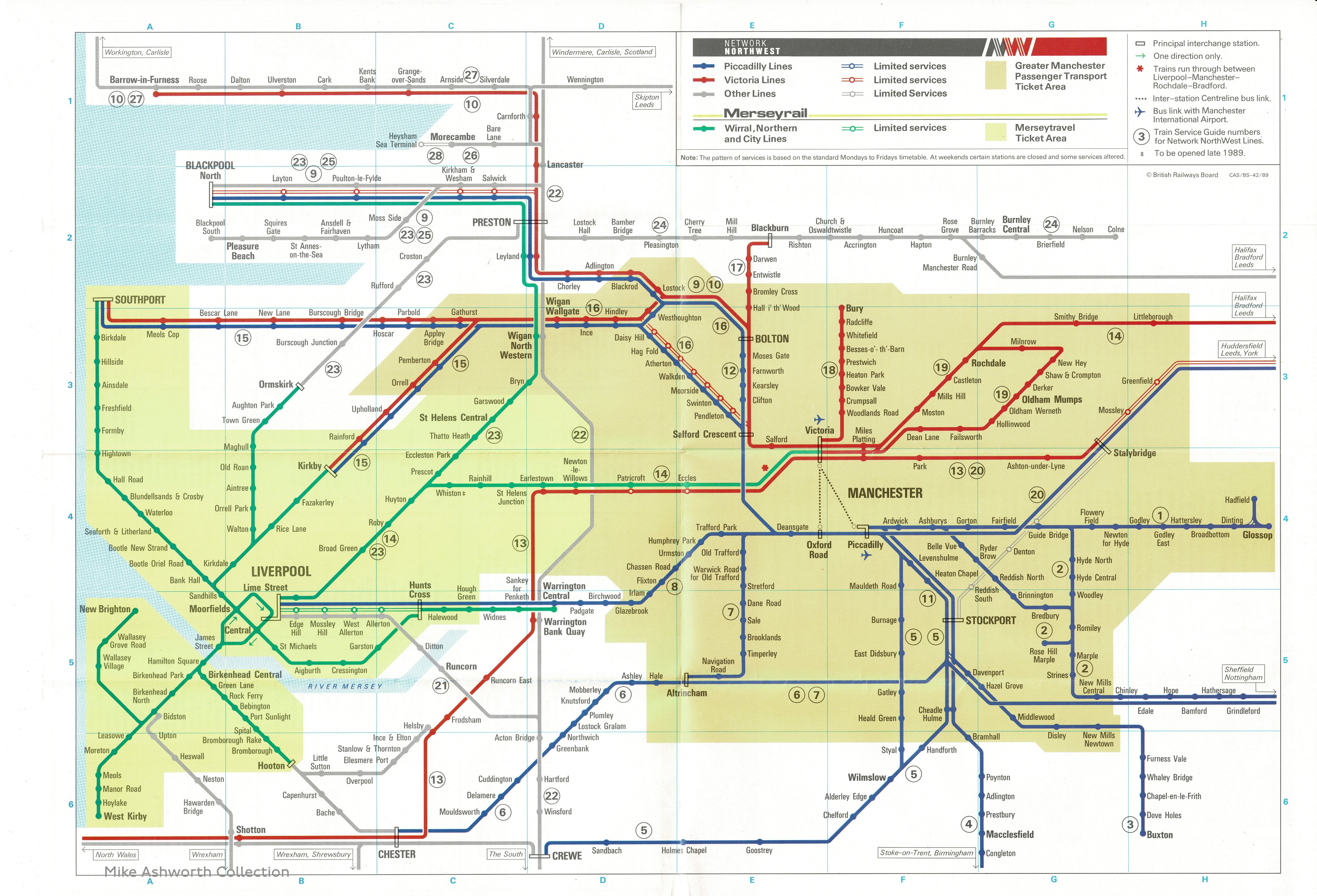
Uses a modified version of the map at the top of this page, showing the boundary of the network by greying out the lines instead of using a shaded box. Why is this system better for this map? Then corrects this by stating at the bottom 'Traincards also allow you to travel to and from Disley, New Mills Newtown and New Mills Central. Lots of admonishments in black bordered boxes: 'Tickets are not valid on Metrolink services outside the City zone' (not actually clearly indicated) and 'Tickets are not valid on rail services outside the coloured zone'. Do coloured lines represent a zone and anyway this is the first mention of a zone - elsewhere it is always called the 'ticketing area'. Thought the leaflet was trying to promote an idea - not present a series of negatives. |
|||||||||||||||||||||||||||||||||||||||||||||||||||
 |
|||||||||||||||||||||||||||||||||||||||||||||||||||
 |
||||||||||||||
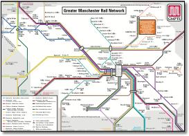
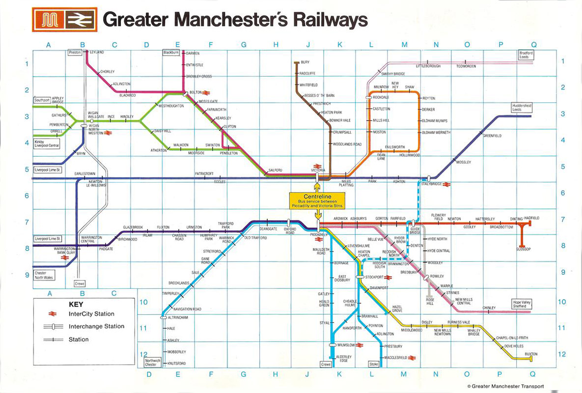
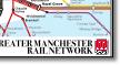
This leaflet presents the same area as the one above, but uses the older GMPTE map as its basis. Lucky they put a red line around Metrolink so we know where it is! The bus network boundary map is horrible, the type almost too small to read, the colour keys impossible to understand. |
||||||||||||||
 |
||||||||||||||
 |
||||||||||||||
 |
||||||||||||||
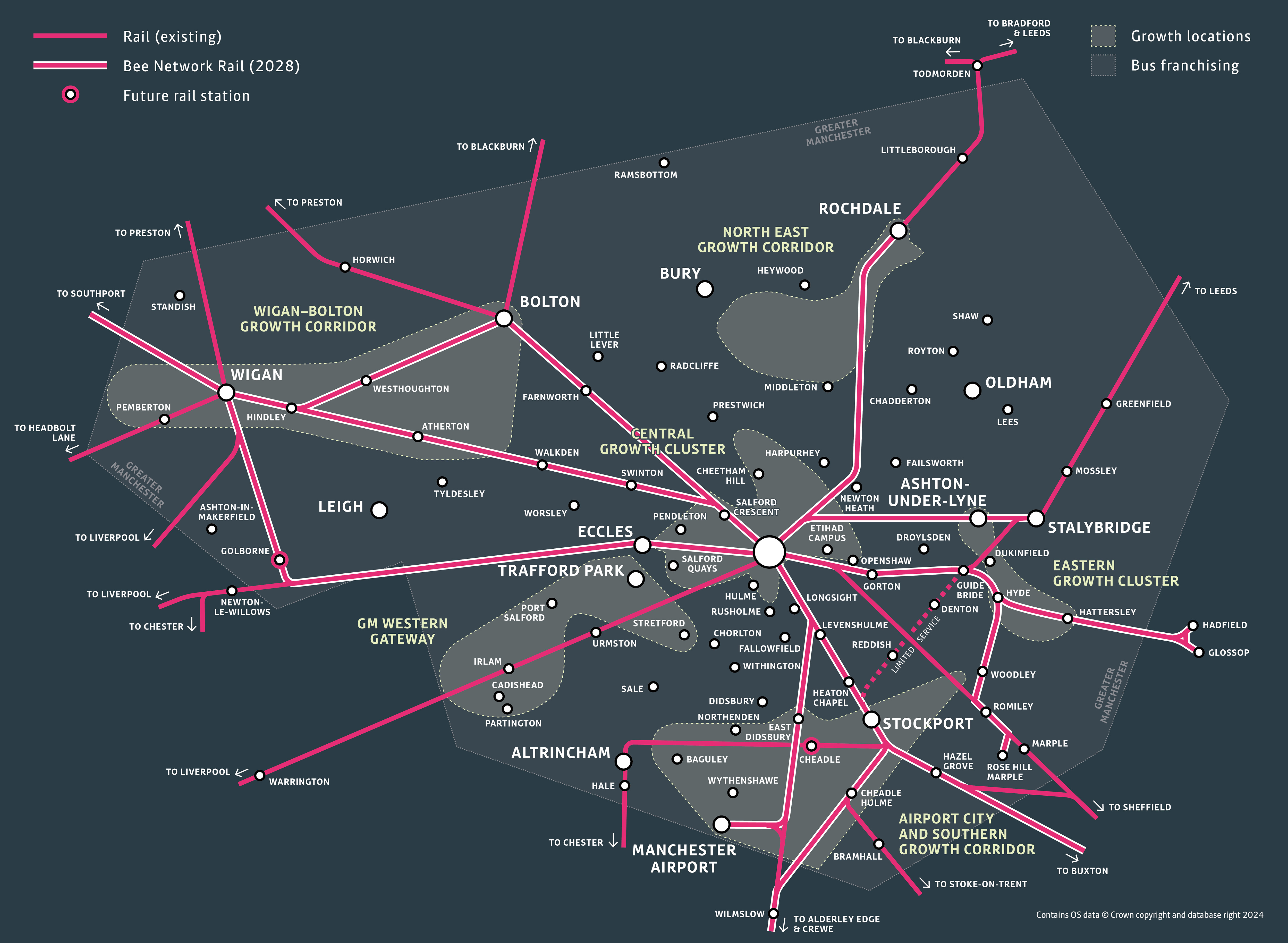
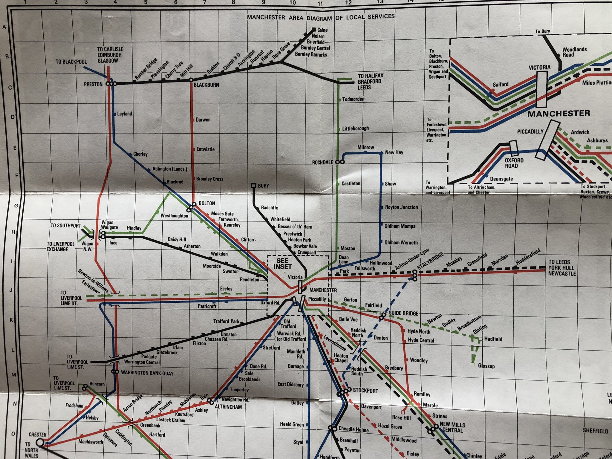
No full review yet, but the whole of the Wigan Bolton area appears to have been turned clockwise through 45º. And manages to get the relationship between the two Wigan stations wrong. |
||||||||||||||
 |
||||||||||||||
%20Map%20Flickr.jpg) |
|||||||
 |
|||||||